| There are three easily accessible areas to Yosemite National Park.
The first is the Tioga Road through Tuolumne Meadows which we passed through
yesterday. The largest is the Yosemite Valley area. We camped just outside
the park and drove in on the scooter. There is a one way loop road round the
Valley to help manage the huge volume of traffic. The first major feature is
Bridal Veil Falls where the water tumbles off the top of the valley and
falls 620ft to the bottom. As the wind catches the water it is blown
sideways and creates the veil from which it takes its name. The view of the
water flow is constantly changing as the wind changes. | 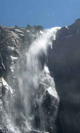 |
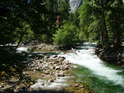
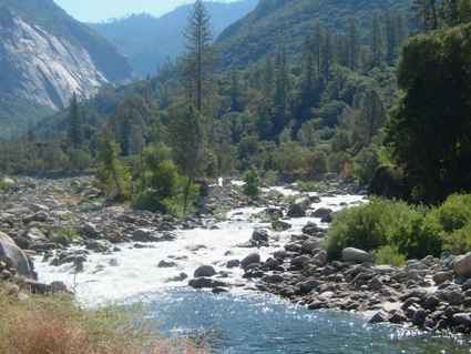
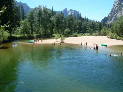 | The main river
is the Merced River but it is supplemented by several creeks along its
course.
This was taken at the Swinging Bridge picnic area, one of several along the
way. People seemed to be enjoying themselves, including those jumping off
the bridge despite several signs saying it is forbidden. |
| This is Yosemite Falls. There are actually three
sections to the falls, Upper (1430ft), Middle (675ft) and lower (320ft). Unlike
the Bridal Veil Falls which flow all year, this and the Ribbon Falls dry up
in the late summer. Perhaps that explains why it did not stand out so much. | 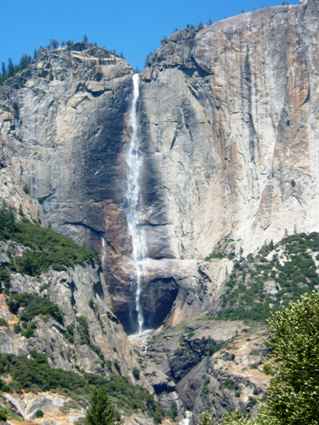 |
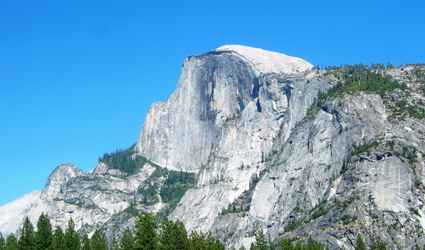 | At the end of
the Valley a large granite 'Half Dome', so called because the missing half
was worn away by glaciers, dominates the skyline. We saw this
from another side yesterday. It is 8842ft high. There is another dome on the
other side of the valley called North Dome which is slightly smaller but is
complete. |
| These are the Cathedral Rocks viewed across Bridal Veil meadow
from the road on the way out. Because there are so many trees the views from
closer are often obscured. | 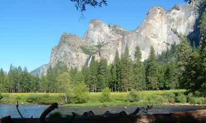 |
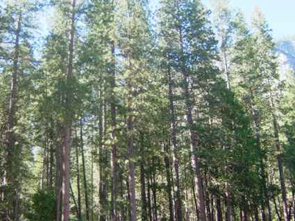 | Although the
park is renowned for its granite mountains and crags and its waterfalls, one
should not forget the thousands of trees. Most people only visit very tiny parts of
the park which covers over 3/4 million acres, most of which are covered in
trees. |
| By the time the Merced river has left the park it has gathered a
fair bit of water from the contributory creeks. This was taken outside the
park on the way down to Indian Flat where we were staying.. | 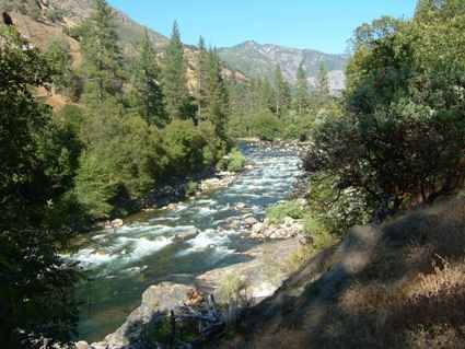 |
 | We actually
spent two days going round the valley, each time passing through the Arches
entrance. The granite slabs just leave enough space to clear an RV or a tour
bus. But that doesn't stop you being nervous. |
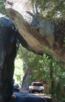
| And when you round the corner coming down the valley this
overhang is a bit of a shock. Just as well the RV is only 11'6" high in the
centre. The rock near the wall is lower than that! There are three tunnels in
the road system and they are not as high as bridges here usually are either. It's an awful long way
round if your vehicle is too tall. | 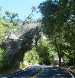 |
 | Yosemite Creek
on the left joins the Merced river just outside the village. |
| We walked up to the top of the Vernal Falls on the Merced River.
This is on the southern side of the valley going round the back of Half Dome.
There is another walk up to Mirror Lake and Tenaya Lake on the other side.
This walk is about 3.5 miles along the Mist Trail and was described as 'strenuous' - allow 3
hours. We took 4.5 and we didn't hang about. The total elevation gain is
1600ft, the last bit up to the top is 971 stone steps, slippery in the
spume. The falls are very spectacular and we even permitted ourselves the
'Awesome' word. | 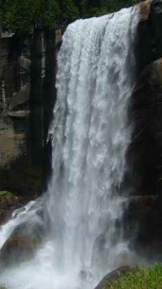 |
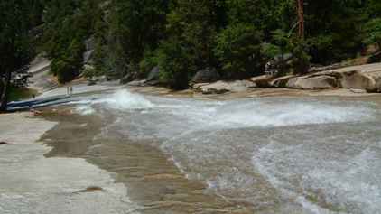
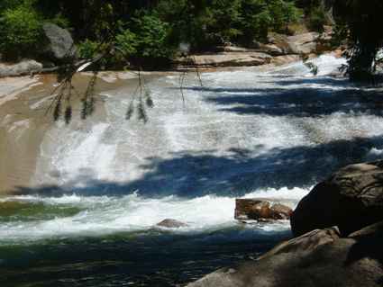 | At the top is a
small pool known as Emerald Pool which is fed by the river flowing over a granite slide. The water
here is very shallow but two inches will take you off your feet. Swimming
and sliding here are regarded as very dangerous and we could see why. Not
that it stopped some folk. |
| The slide is fed through a narrow ravine through which the water
tumbles with unbelievable force. I cannot comprehend what this must be like
with a snow-melt coming through. This was minimum water time! | 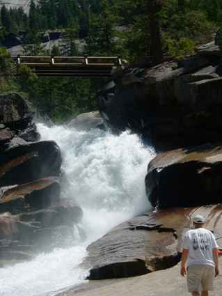 |
 | Although I
described it as a the water slide, it does have some rocks and hollows in it. Just
note the bit just to the left of centre where the water encounters a hollow! |
| The problem with waterfalls is that you really need to view them
from the right angle. This is a 317ft drop. You can just see the people to
the side and the rainbow caused by the spray. We had climbed a lot higher in
order to return by the John Muir Trail, named after one of the early
pioneers who helped create the park. | 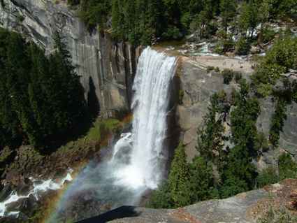 |
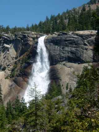 |
Further up the valley from Vernal Falls is Nevada Falls (594ft) at an
altitude of 5910ft We didn't walk up that trail but got an excellent
view from the trail we did take (and we topped out about 6000ft). Fortunately
the trail down was a horse (mule) trail so didn't have the slippery steps of the one
going up. But we were pretty tired by the time we returned to the valley
floor (4000ft). |
| One of the well known sets of peaks is the Three Brothers seen
here from the road to the south. The trees up the valley sides in front of
them give you some idea how steep the valley sides are. | 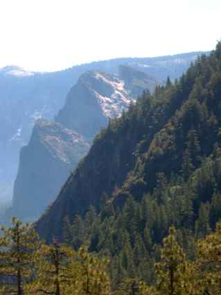 |
 | But as you leave
the park the valley sides are at less of an angle and the scene seems a
little more peaceful and less harsh. Very pleasing at the end of the day. |
|