| We stayed on a site at Lee Vining, looking out over Mono Lake and
just a couple of miles from the Tioga entrance to Yosemite National Park.
But first we travelled a little further south, still with mountains on the
right. These are in the Ritter range. | 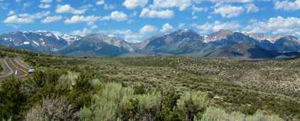 |
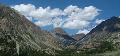
 | We wanted to go
round the June Lake loop which has several small lakes in mountain canyons. They
looked very peaceful. There were a number of camp sites in this area which
we must check out at some point in the future. |
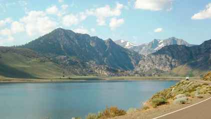
| This was Silver Lake. The June Lake loop is only 14 miles but it
was one of the nicer places we have visited and very quiet without the 4
million visitors/year of Yosemite only a valley or two away. | 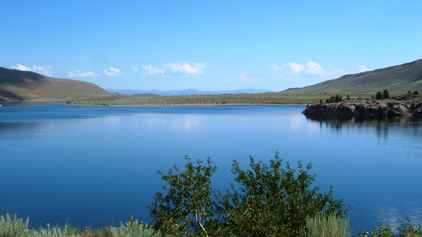 |
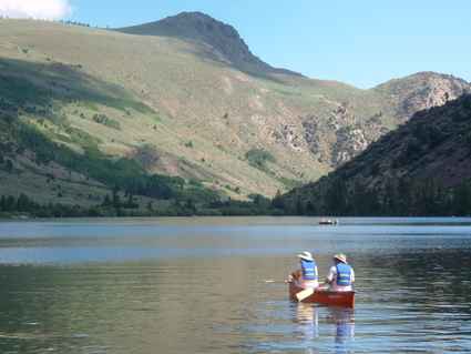 | June Lake itself
had some tourists out there in the canoes idly trying to catch the odd fish
or two. This was definitely worth the side trip.. |
| We returned to the main road and headed back towards Lee Vining.
But just south of the lake we turned off on another side trip.
Roads in America are generally litter free because each two mile stretch
is kept clear by somebody, usually a local organisation or business, and
there is a sign to tell the world who (and it is a bit of free local
advertising). This
was unusual and took our fancy. | 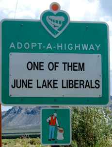 |
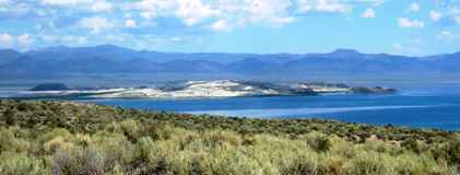 | Just
down this road we had another view of Mono Lake, this time from the south.
The island is called Paoha and is an old volcano dome. There are other
younger volcanic domes in this area, which is still quite active
geologically. |
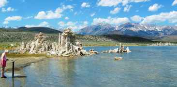
| Underground springs abound around the lake and as they rise they
deposit calcium salts around the outlets. In earlier times the lake level
was much higher and these 'tufa' were under the water. Now the lake level
has fallen so much that they are exposed (in their hundreds). There is a
small state park and interpretative trail explaining the tufa and their role
in the lake. | 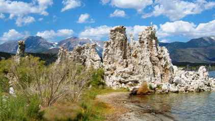 |
 |
The lake is to be returned to within 25 ft of its original level, which will
cover the tufa. It remains to be seen if the extra fresh water will alter
the lake chemistry enough to enable the birds to return to using the lake as
a refuelling station. |
| So we eventually returned to the Tioga Road climbing up into
Yosemite National Park. The pass at the top is at 9945ft, one of the highest
entrances we have been through. Our National Park pass again gave us free
entrance. This just has to be wonderful value. | 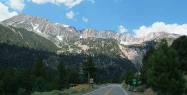 |
 | From the main
road to Tuolumne Meadows is 17 miles, mostly through scenery like this. There
are few trees this high. The road climbs inexorably to the summit. |
| Just below the summit is the aptly named Summit Lake. Even
at this time, the hottest time of the year, it is quite cool here - I
wouldn't want to go swimming here. | 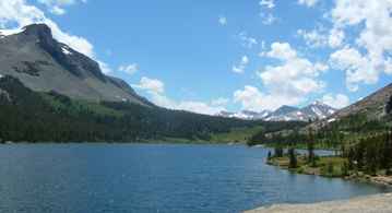 |
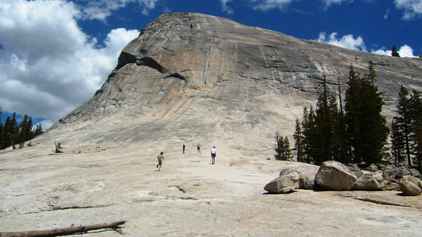 | This is Lembert Dome, a giant block of
granite. There is a route to the top which offers spectacular views over the
meadows. |
| This shot from a little further away shows the Tuolumne Meadows
in the foreground with the
Tuolumne river running through. After the deserts of Nevada this was green
and lush. Due to the high elevation spring comes quite late so many of the
wild flowers bloom in June and July, but we were just a little too late for
them. | 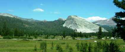 |
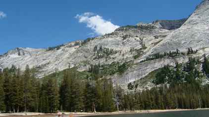 | The stone here
is almost all granite and rises in sheer sheets and is very smooth. It is a
mecca for rock climbers who come to test their skills against some of the
toughest climbs in the world.. |
| A bit further along the Tioga Road, which runs for 55 miles
through the Park, is Tenaya Lake. It is about a mile long with a sandy beach
on the northeastern shore. | 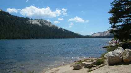 |
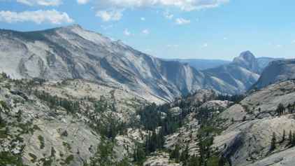 | One
of the most popular stops along this route is Olmsted Point where you have
an extended view over the Tenaya Canyon with the granite bulk of Clouds Rest
on the left and the back of Half Dome at the end. |
| Eventually Tioga road reaches the junction to Crane Flat and
Yosemite Valley. We turned towards the valley and headed downwards towards the
valley bottom. We passed this area where the trees had been burned in one of
the many natural fires, usually started by lightning, which occur in the park
each year. It is called Great Meadow. | 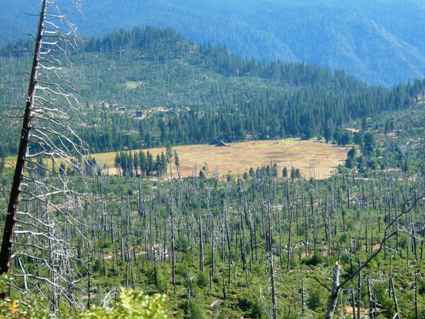 |
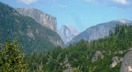 | From the road
down you begin to be able to see into Yosemite Valley, first with this shot which
just shows the Half Dome peak between El Capitan and the Cathedral Peaks. |
| Then as the road descends further you begin to be able to see the
valley floor with the Merced River flowing out of the valley
and towards the town of Merced some 70 miles away. We will be following that
river out of the park towards our camp site at Indian Flat some 10 miles
down the road. All of the sites in the park (and there are many) were full,
and this is usually the case for the entire holiday period. | 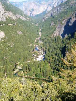 |
|