| Leaving Mt St Helens and Washington State, we crossed the
Columbia River on an impressive bridge (it's a BIG river) and turned west
alongside the estuary. After about 50 miles we reached the coast and turned
south reaching a town with the imaginative name of Seaside. With this
impressive beachline we wondered if the whole coast is one long beach. | 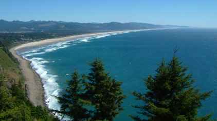 |
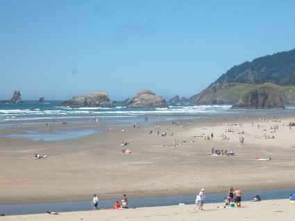 | After the absence
of shoreline condominiums and people on the beach, Seaside looked a little
more like the seaside we knew - with people, but still not many for late
July. In fact this turned out to be the most populated beach we found. The
beach itself was excellent but the town was not unlike many English seaside
towns - seen better days. |
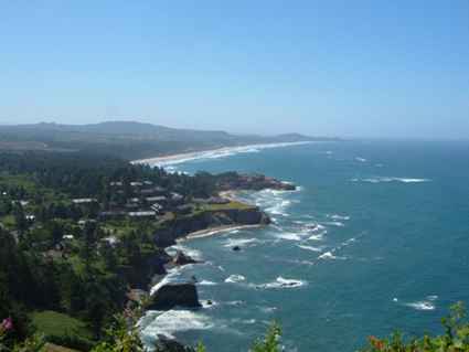
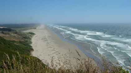
| It is not all flat, there are rocky headlands and smaller bays
with the waves crashing in. But these are not generally surfing beaches as
there are too many warnings about rip currents.
Perhaps the presence of so many rocks (volcanic basalt in origin) makes them too
dangerous. But equally we didn't see what we understand to be surfing waves.
The views from the many viewpoints along the coast road are very pleasant
though. | 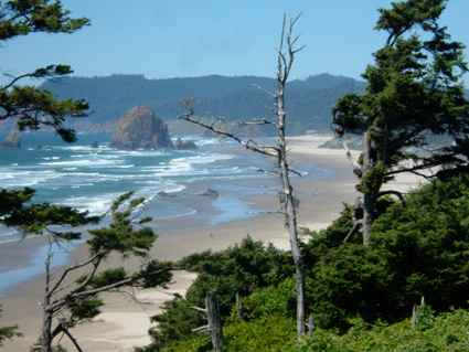 |
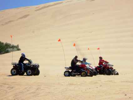
 | Next down is Cannon
Beach, known for its dunes and ATV runs, but also for the rare grasses. In
the 1900s, non-native European beach grass was introduced to help stabilise
the dunes. This lead to some loss of the native species which they have been
trying to reintroduce. The small town is also popular with artists and was
full of touristy art shops. |
| Perhaps what
keeps the people away is that it is never as hot on the coast as it is
inland, often by as much as 30°F. In part this
is due to the almost constant sea frets which block the sunlight and reduce
visibility. It does, however, lead you to think the beaches go on for ever.
It is also rather windy, and despite being the Pacific, the sea is cold due
to currents flowing down the coast from Alaska.
This may well be Manzanita or Nehalem beach
which both looked well worth exploring, as we passed onward to Tillamook. . | 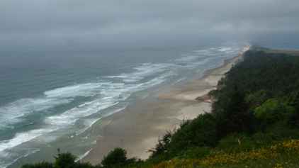 |
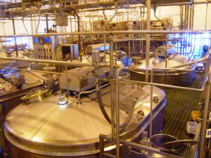 | There are also
many tourist attractions, most of which we avoid but this was slightly
different. We visited the Tillamook Cheese factory which is known nationwide
for the quality of its cheeses. There was a self-guided tour and you could
look out over the factory floor. Here we have the vats starting the
cheese-making process. This part was fully automated and very clinical.
However there was one bit where they still make it by hand so that the
cheese makers understand and have a feel for the process. |
| The packing plant is amazing but we were surprised at the degree
of manual intervention. This factory largely produces cheddar. The Americans
are not generally very adventurous with their cheeses. Anything not a
variation of cheddar or mozzarella doesn't make it to most supermarkets.
There were a number of stations weighing each block with a human either
adding a slice or taking one off. The colour peculiarities are a function of
the lighting here. | 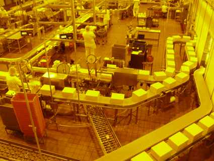 |
 | From Tillamook the
road goes inland for a while before returning to the coast at Neskowin. Then
it passes through a series of forgettable towns (sorry, cities, pop 2000)
moving southward towards Depoe Bay. The coast is quite memorable but the
places aren't. Depoe Bay harbour is reputed to be the smallest
navigable in the world. It certainly has the narrowest entrance we have ever
seen. |
| Some of the beaches are quite hard to get to. There probably is a
way down but we didn't stop. There are many state parks which give public
access. Oregon law leaves the beach in public ownership, but there are some
areas where the cliffs are privately owned. There are some houses with
fences and automatic gates but most look like holiday cottages and are often
not in too good a shape. Bear in mind that most of this coast is from
100-300 miles from any significant population centre. | 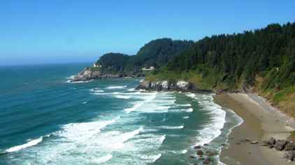 |
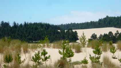
 | But you still
can't fail to be awed by beaches looking like this. We moved southwards
towards Florence and the start of the area known as the Oregon Dunes
National Park. |
| We went on the dunes in an area reserved for people (not that we
saw any). To the south of us was the area designated for ATVs and similar
off road vehicles. But given that this area is at least 50 miles long, it
was not surprising we saw and heard nothing. | 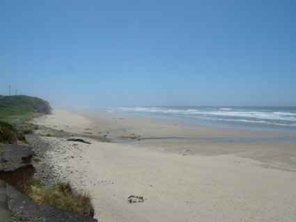 |
 | Most of the
traffic was back in the dunes near the car parks. It seemed to be mostly
dads and sons racing each other up the steep dune sides. Not really our
thing. We watched for a while and moved on. |
| We did go on a couple of walks through the zone reclamation areas
where they are trying to stabilise the dunes using native grasses. But this
is a harsh environment and such work must inevitably be long term. Then
there are hundreds of square miles of dunes. Some areas have fairly
extensive tree cover but this is an area to explore from the boardwalks, you
could get seriously lost very quickly. | 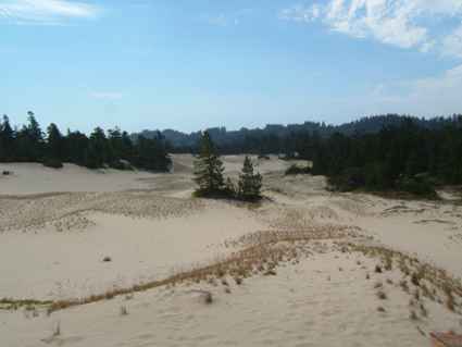 |
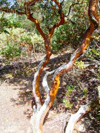 | There are also
expanses of myrtle trees with their very distinctive bark colourings. A
number of the gift shops sell artifacts made of this wood but we aren't in
the collecting business. We haven't space. |
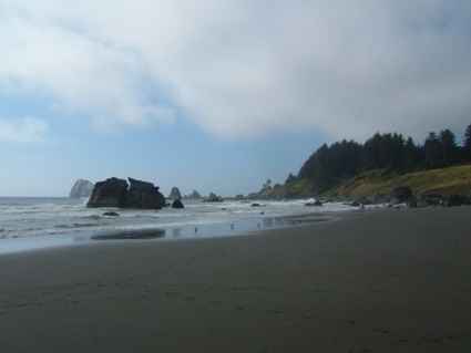
| And so southward to Coos Bay, the largest centre of population on
the coast, then Bandon and Port Orford. This is Nesika Bay where we stopped
overnight, but it was a bit cool for the beach. Besides it was becoming a
bit like it had been in the mountains - Oh look - another beach.... | 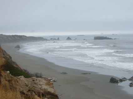 |
 | As we moved further
south the sea frets became more common and the temperature cooler. Whilst
this is not to the liking of homo sapiens, the fog produces just the kind of
conditions which favour the growth of the giant redwood trees. We headed on
to Brookings, the last town in Oregon, before hitting the California border.
Here we were stopped to check we had no citrus fruit on board. We had just
bought some oranges, but since they were Australian oranges, they were
deemed OK. Go figure. |
| We had seen natural stone bridges down in Utah. But they also
occur on the coast. We passed these along the way as a welcome intermission
from beaches. | 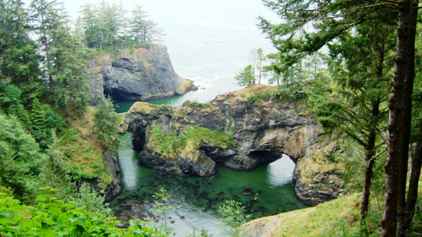 |
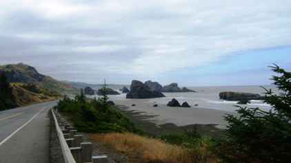 | And so along
the California coast which was not a lot different to the Oregon coast
really. This is about 30 miles down from the border, just south of Crescent
City (again more of a town). However it was almost wiped out in 1992 by a
tsunami caused by an earthquake in Alaska. This shows how close to sea level
it really is.
A few miles south of here is Klamath and the Redwoods National Parks, our
next target area. |
|