| Moving west from Glacier, we were reminded that we were still
high up but that the mountains are still higher. The clouds give you a small
reminder when conditions leave you early morning cloud in the valleys. | 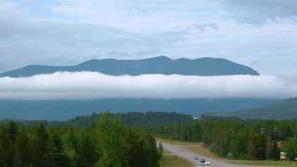 |
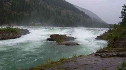 | As we drove
west we passed a sign for a short walk to Kootenai Falls. We had been
driving along the Kootenai River and had remarked on its size. But as before
the photo is a pale imitation of the sheer raw power in these falls. They
are not as high as some but the sheer power must take some beating. |
| I've no idea how many gallons of water flow over here but it must
be measured in millions. | 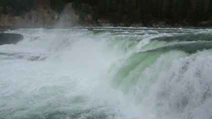 |
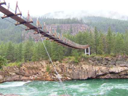 | Just downstream
from the falls is a swing bridge. I'm not sure where it goes or why it is
there but it was interesting to wander across.... |
| There are many deep valleys we have crossed over often with
timber trestle bridges or more often metal replacements. This is over the
Moyie river. This is the second highest bridge in Idaho. (The Americans are
really stuck on the statistics.) Just up the gorge is the Moyie Dam which
has a higher fall than Niagara Falls. (Not a lot of folk know that). | 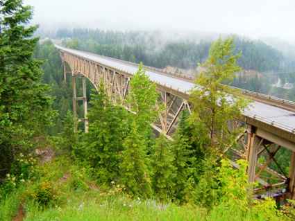 |
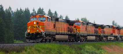 | You always know
you are back on US 2 because the railway follows this across the whole USA
(most cross country routes are the same). Here we have a slightly unusual
collection of four BNSF engines heading up a lengthy train. Unusual
because they were colour coordinated - BNSF has umpteen different liveries
in current use. |
| This was a period of quite threatening weather which we now watch
with some caution since we have experienced what it can do. Someone was
going to catch this lot. Indeed we caught some of it after we left Grand
Coulee and headed north into Indian country (Colville Reservation where
Chief Joseph of the Nez Perce is buried). | 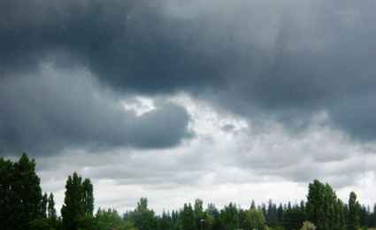 |
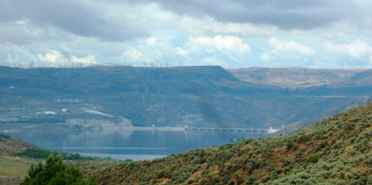 | We travelled
down US2 and stopped over in Spokane. But we had difficulty finding an open
site and in the morning decided not to stop. We wanted to get up to Grand
Coulee Dam which entailed a diversion off US 2. Here the dam is just coming
into view and you get some idea of just how huge this project was. |
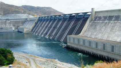
| As with many of these places there was a visitor centre with an
audio visual presentation. This told us lots about FD Roosevelt authorising
it but little about who conceived it. Yes it is a dam, but it is a power
station (6000MW - 3x Drax or Ferrybridge), an irrigation system which made
miles of surrounding land usable as farmland, and a flood control system for the
Columbia valley. From the video we would have thought it was a work creation
scheme. | 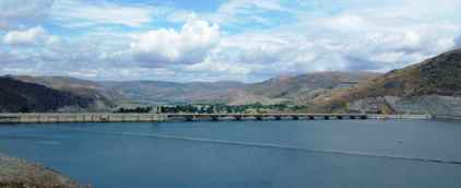 |
 |
Originally there were two power plants, Left and Right. A third was added
later, at the far left. |
| The spillways are often the image of what a dam is. You often
loose sight that this dam is 500ft high and 500ft wide at the base. This
holds back one of the few reservoirs we have seen which is full. | 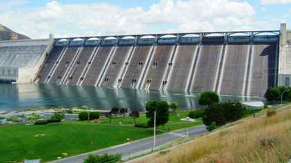 |
|