| We started from our campground in St Mary and headed north to
Babb and then west along Sherburne Lake to Many Glaciers Lake. This is the
trailhead for many walks but we elected to do just a short 3 mile loop round
the lake.. | 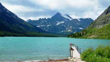 |
 | The 'U' shape
is very characteristic of glacial valleys. Several glaciers drain into this
point hence the name of the area and the lake. The differing blues are a
function of sunlight angle and varying depths. The weather was variable with
quite a strong and bitter wind blowing. |
| We kept coming across these grass heads of what we later learned
is bear grass. Apparently it only flowers every five or six years and this
is obviously the 'flowering' year because it is flowering profusely everywhere. The grassy
tussock at the base is the main plant. It looks like a variation on a yucca. | 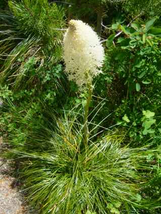 |
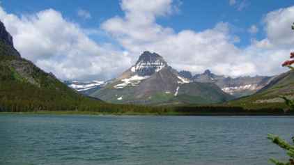
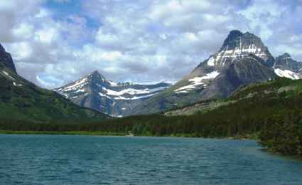 | Another view of
the lake, this time almost from the hotel at the east end.. |
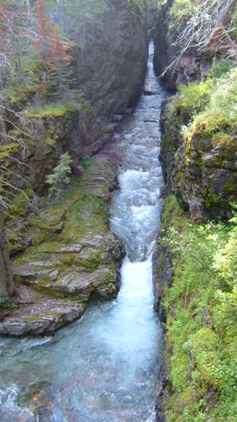
| This is just downstream from the lake as the waters start their
journey downstream through Lake Sherburne to Lower St Mary Lake at
Babb. There was quite a bit of water flowing so the results were quite
impressive.. | 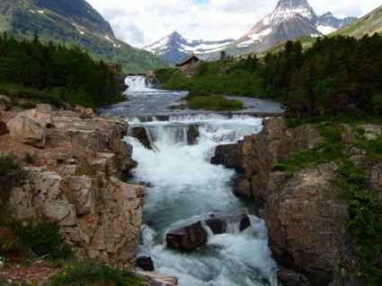 |
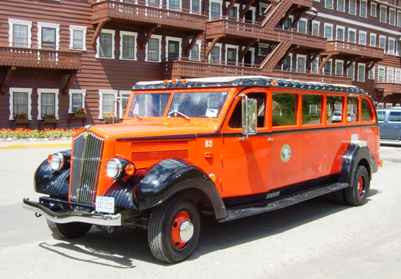 | All around the area we
kept seeing these 1936 White coaches. There are 33 in the fleet and they
provide tours of the area, sometimes with the roof open and sometimes
closed. The buses have been completely rebuilt. The bodies are original oak
frames but they now have new Ford chassis and engines just like an RV. Bit
more power than the original 12HP engines, and to be environmentally
friendly they now run on propane!. |
| The Many Glacier Lodge has an impressive four storey atrium using bare
Douglas fir
trunks going all the way up. The hotel has undergone major reconstruction
since it was discovered to be falling into the lake! It was built by the
Great Northern Railway company to encourage tourism and thus passenger
traffic on its line. We had coffee here then returned to St Mary to refuel and go up the Going to
the Sun road. This 55 mile road across the park has a vehicle length limitation of
21ft on it so we knew we had to view it in sections from each end by
scooter. | 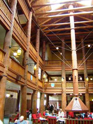 |
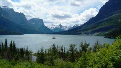 | This is
apparently one of the most photographed and painted points in the park. The tiny island
in the middle is Goose Island. No geese at this time of year. |
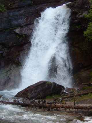
| As we progressed along the road, several spectacular features
appeared including this huge gulley, again, I suspect, carved by a glacier.
The waterfall part way up is not small. The road just beyond this area has
waterfalls cascading down onto the road every few yards at this time of year.
We could easily
have got soaked in the freezing cold water. | 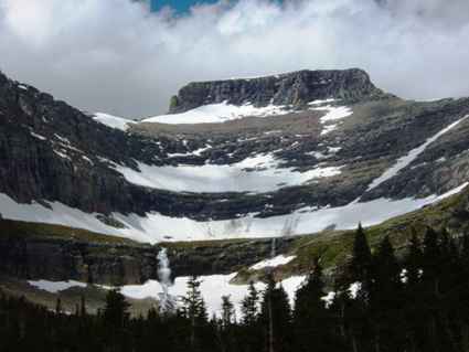 |
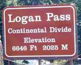 | So to Logan Pass,
the
highest point on the road and which is only about 20 miles in from the east side. This marks
the continental divide so waters from beyond here go to the Pacific. A bit
further north in the park is a three way divide because one river flow out
to the Arctic Ocean by way of Hudson Bay.. |
| The views from the visitor centre are spectacular particularly
since most of the snow had not melted. This road is only open from mid June
to mid October. We had wanted to see the wild flowers in the alpine
meadows on a walk up to Hidden Lake, basically in the direction you
see, up and over that ridge about 400 ft up. We had not expected snow and were not well equipped for
this outing, and we thought it was getting a bit late to start. | 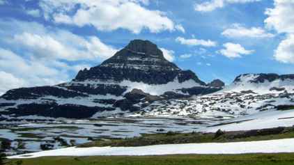 |
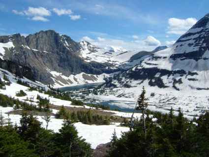 | It is about
1.5 miles to the lake which you can see below in the valley here. However
much of the surface was still frozen over. The wind was blowing pretty
strongly and the clouds kept covering and revealing the sun so the view
changed by the minute. |
| This is the view to the right of the one above showing the end of
the lake and the hills down the valley towards the Pacific (through which
gap the wind came!). | 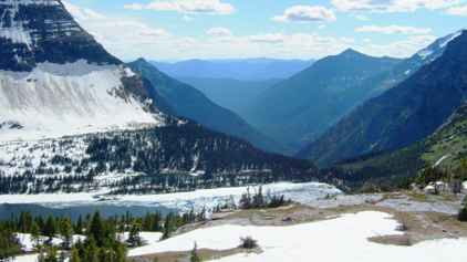 |
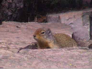 | Despite the
desperately short summer and very harsh winter these Columbian ground
squirrels were hard at work gathering, oblivious to the presence of humans.
I also saw other similar sized creatures but they all moved too fast for the
camera.. |
| Not so this bedraggled motheaten looking mountain goat which ambled
through. The walkways of the viewing platform were just an easy way to get
from A to B for him. He has about three months to lose this coat and grow a new one.
-40�F is not uncommon here before any
wind chill, and 100mph winds are not unknown. | 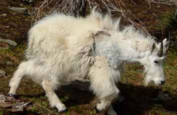 |
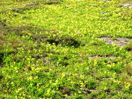 | Still some
things do survive and bloom despite (or maybe because of) the conditions.
These glacier lilies formed a carpet on the little bits of meadow where the snow had
melted.. |
| This is the view back from Hidden Lake, the path goes through
there and then down some 350ft. Going downhill was not far short of a
controlled fall. I think, in hindsight, coming back down was worse
than going up. Mind you, looking at some of the people still setting out, we
wondered how some of them were going to make it, and many obviously
wouldn't. | 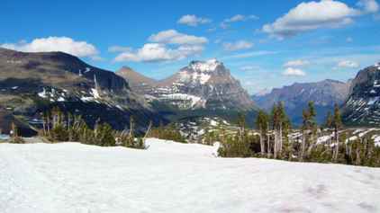 |
As the sun goes
down in the sky, it really sets off the shapes and colours in the rocks. The
striations in these cliffs really show up. The colours may not come out
well here but the overall spectacle is quite awesome.
 |
On the way back down we paused at Sunrift Gorge. Here the water tumbles
down a long narrow gorge and it was obvious if we waited for the right moment,
then the setting sun would peep down too. Walking a short distance in the
other direction, past several smaller waterfalls, we came to Baring Falls. They
all form a small river (torrent) which descends into Upper St Mary Lake. |
 |
We did 85 miles on the scooter and it was too far. Carrying two stresses
it and us and for 85 miles in one day, it stressed us too much. |