| As we left Custer we called at the visitor centre to enquire if
our proposed route was suitable for a 32ft RV. They advised that this was a
gravel road and of uncertain condition following the recent heavy rains.
Since we had over 50 miles of that road to cover we opted for a slightly
longer and, theoretically, better road. In hindsight they might have been
right, but only just. Most of the county roads in South Dakota are gravel and
the paved ones through Indian reservations are not the best maintained. Even
quite small towns have fairly good visitor centres and this was no
exception. Outside was a statue of non other than General George A Custer
himself. | 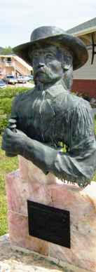 |
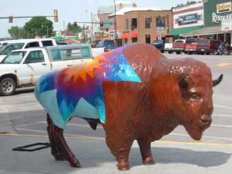 |
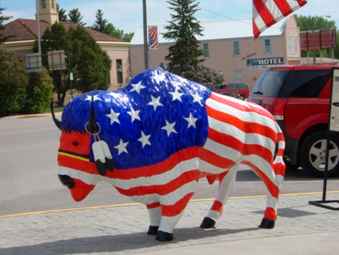
Being in the heart of buffalo country (yes there is a Buffalo in S Dakota),
there just had to be a buffalo on every corner. These were just two. |
 |
| It always amazes me when they talk about herds of buffalo. Very
rarely have we seen more than a single solitary lonely and miserable looking
buffalo. Often they are only a tiny brown speck in a sea of green. They must
measure density in square miles per buffalo. This one was obligingly close
to the road, and even posed for the camera. | 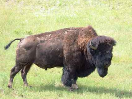 |
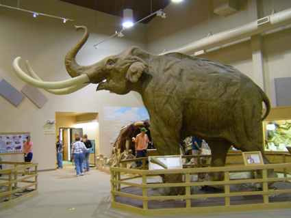 | Having gone for the
main road route we passed through the town of Hot Springs (pop 3500). And
unlike Mammoth Hot Springs, this one had mammoths as well as hot springs. Or at least the
archeological remains thereof. Apparently a cave deep underground collapsed
causing all above to collapse and create a steep sided hole which filled
with water. Over time a collection of mammoths and other creatures fell in
and were drowned. Then rain washed in sediment and the calcium in the water
created fossils. Since the site is so small they have built the museum right
over it. They have over 100 mammoths in this small site, mostly
Columbian, but they have found four woolly ones so far. They are still
digging (wow, an air-conditioned covered dig - no shortage of volunteers!) |
| Some of the skeletons were damaged by bulldozers, which is how
they found the site. Others have only partial remains but some are almost
complete. The team have given the most prominent ones names such as Napoleon
Bone Apart. Most of the bits from the woolly mammoths have been removed as
part of an international study with experts from Siberia. (Which is how they
came to know that woolly mammoths were woolly - the Russians found one that
was still woolly) | 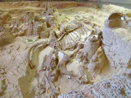 |
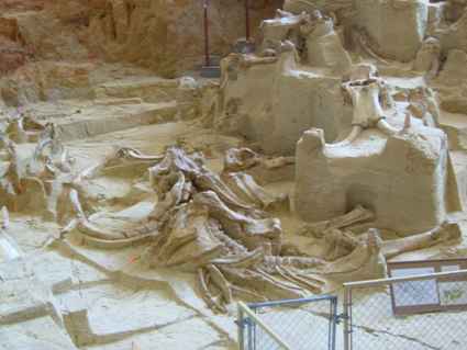 | The bones are only
partially exposed in order to create maximum public interest (and thus
income) but the team are now caught between leaving the top specimens on
show or digging down through the remaining 45 ft to see what is underneath. They
have only done 22 ft to date. The tour was informative and we could wander
round on our own afterwards. There was also a small exhibition of related
items. |
| Once we passed Hot Springs and turned onto the Sioux Reservation,
the distances became considerable and the scenery deadly boring. The road on
the map is straight though in real life it goes up and down. | 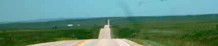 |
We had travelled down this way to visit the site of the Massacre at Wounded Knee. On the way we passed through the reservations of two of the Sioux groups. The village of Oglala was very depressing and looked to have some of the worst social conditions I have seen anywhere. There were a number of signs along the road advertising services which suggest that infant mortality is still a serious problem here.
Most of the houses were small prefabs on small plots surrounded by junk cars
and scrap. Much like we would find at a gypsy encampment.
The Lone Pine centre looked marginally more prosperous but not a lot. I
have been reading about the Utes in Utah and some of them made their way up
here and apparently were shocked that the proud Sioux were such a shadow of
a people. That was in 1890 and it doesn't look like much has changed. Mind,
the post Indian-wars handling of the native peoples does not make
comfortable reading and in some ways is continuing.
We had wanted to visit Wounded Knee but the area was a great
disappointment with poor signage and a visitors centre which offered no
assistance or information. Given the number of tourists which passed through
in the short while we were there, I certainly expected more to have been
made of it. The Crazy Horse Memorial was on another planet for organisation.
We decided to cut our losses and head for the Badlands in the north.
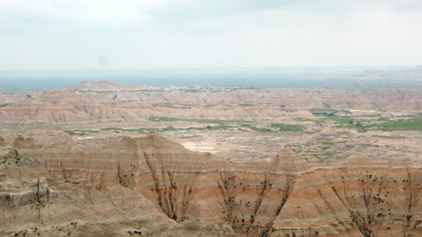
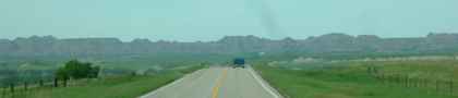 | After the seemingly
endless plain it was a relief to reach the 'wall' which marks the S Dakota Badlands.
This cliff is some 80 miles long and forms a virtually impenetrable barrier
to travel north/south. |
| In some ways we had seen scenery like this before in southern Utah.
But here the features were smaller and sharper, thus enabling you to grasp
the scale a little more easily. It is still surreal and like a moonscape. The
northern part of the park is only about 10 miles deep but is so much longer
east/west.
Then there is the southern section about which even less is known, down in the
Sioux Reservation. | 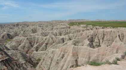 |
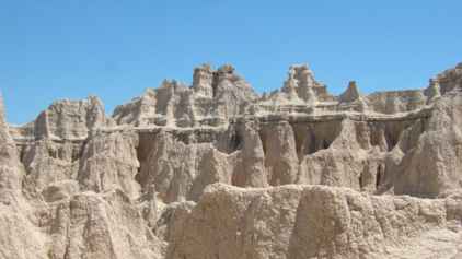 | These are
obviously sedimentary cliffs but at various times there have been different
deposits, usually with more iron in them. So the whole range has these red
horizontal bands showing the different layers.. |
| Erosion has played its part here and there have obviously been
rock collapses over the years. But the sharp ridges and pinnacles are a
feature we have not seen in such a pointed way elsewhere. We did one of the
short walks to a point called he Notch and were rewarded with this
spectacular view south over the reservation plains. |
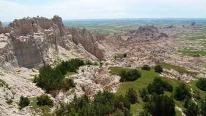 |
 | There is a
scenic drive of about 40 miles through the Badlands. We did the eastern leg
of this on the Thursday but left the longer western leg until the Friday as
we left for North Dakota. Most striking are the red bands which pass
through the strata. These are the results of different sedimentation
periods. For once it wasn't raining which was a pity since the red shows
even more spectacularly when wet. |
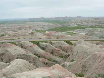
| The road travels along the top of the wall which offers
spectacular views south (and north). The red ridges show up really well. The
view in the distance was not so visible because of the haze. This would
probably be better later in the day as the clouds cleared. | 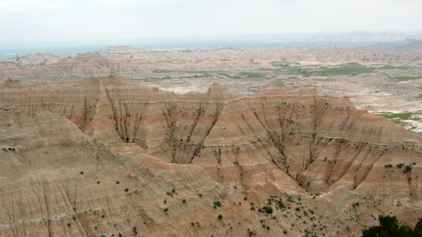 |
 | We travelled
further on the road and found many more views all of which showed the
differing strata and the views.. |
| Then we came to an area known as Yellow Mounds, the reasons for
which became quickly obvious. The yellow was caused by the remains of the
jungle type vegetation present in this area but the process was much the
same as for the other levels. | 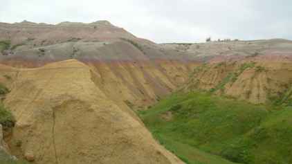 |
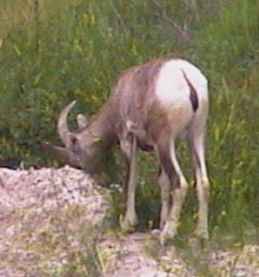 | Finally one should
not forget the wildlife - yes, there is some even in this inhospitable area.
We believe that these were some of the resident longhorn sheep, but to me
they looked more like goats.. |
| They certainly acted like goats. The cliff this family was on was
virtually vertical and all three were walking while we were there. But it
was another of the rare animals which we had managed to see. The photo
quality is not good but the photo is at full magnification (320x). Even
though this photo was cut from the original frame. | 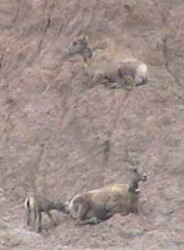 |
|