| A view of us at the
campsite at Capilano next to the totem pole. This is Indian land. Joe
Capilano was a Squamish chief who led a delegation to England to ask Edward
VII to grant them their lands. They still claim title to most of Vancouver
and up to 500 miles to the north. | 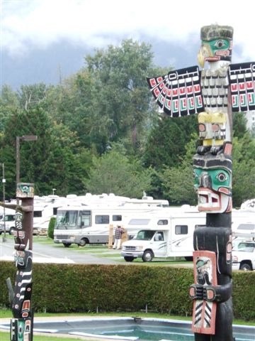 |
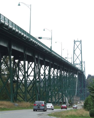 |
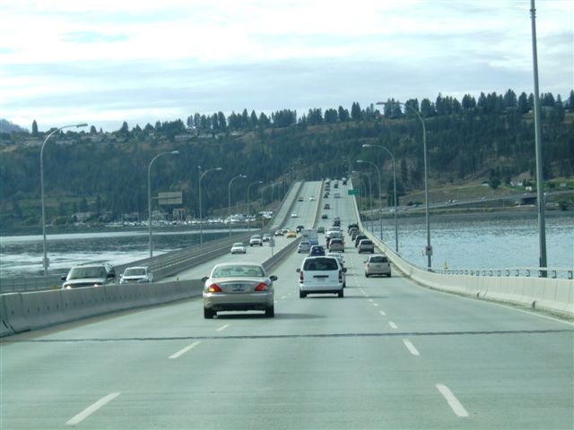
Rising above the campsite is the Lions Gate bridge which carries traffic
from the north over the Burrard Sound to Vancouver city. It is almost 6000ft
long and provides 60m of clearance for ships entering the harbours. |
| We drove north up the
BC99 towards Whistler. The signs are phonetic representations of the names
in the Squamish language. We don't know what '7' sounds like! Distances in
Canada are in kilometres. | 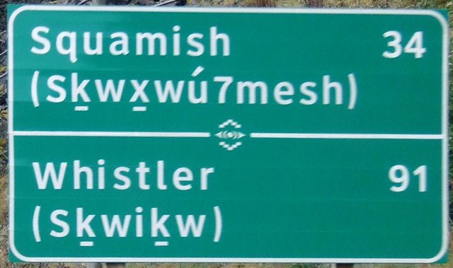 |
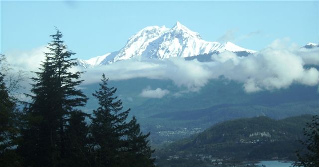 |
This is Mount Garibaldi (8786ft), a dormant but potentially active
stratovolcano in the coastal mountains. The Squamish call it 'Grimy One'. It
last erupted 10,000 years ago. It overlooks the town of Squamish. |
| We were heading further
north but stopped at Brandywine falls. This is a 70m drop on the Brandywine
creek. The surrounding rock is basaltic lava from at least four flows in the
last 34,000 years. This is the northern end of the Cascade mountains. | 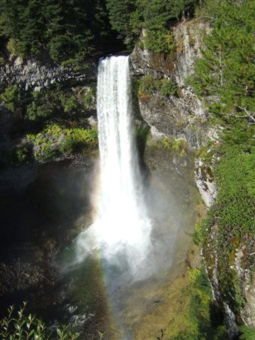 |
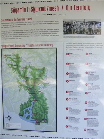 |
The notice boards in the parking lot talk about the Squamish people, their
beliefs and links with the land. Jan was particularly interested in the
phonetic spellings. I would like to have known more about how they work with
the government and how much say they have over the use of the land. 22
Salish bands joined together to form the Squamish nation and they still
retain their languages. |
| The village of Whistler
is about 125km north of Vancouver and is at 2200ft. The mountains are around
2200 metres or almost 8000ft, hence the snow cover. Skiing season does not
really start until December. | 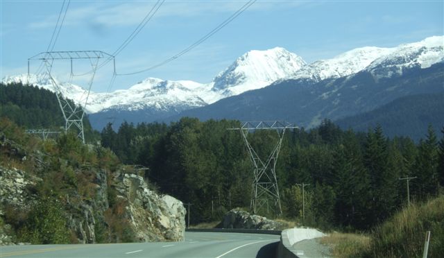 |
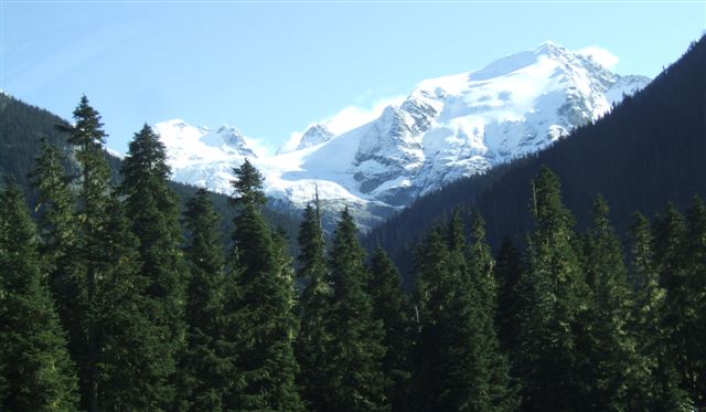 |
Actually seeing snow covered mountaintops is quite rare. Usually they are
shrouded in mist or clouds. |
| Although this is quite a
main road, it gets progressively narrower and more twisty as we head further
north. There is also less and less traffic. | 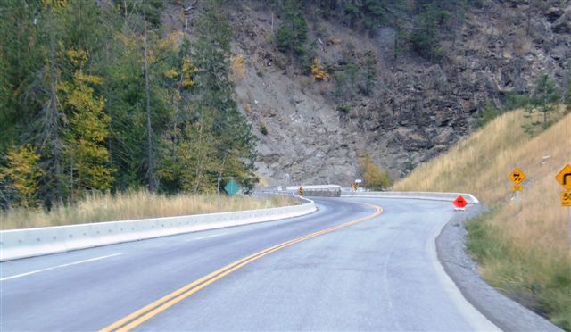 |
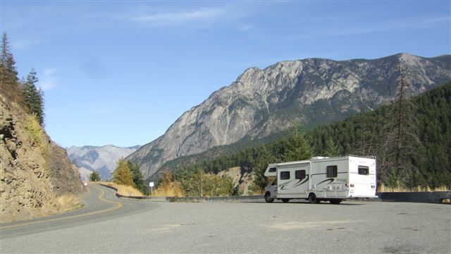 |
We drive for a couple of hours and then look for somewhere to stop for a
coffee break. There are often laybys and viewpoints with space to pause
along the journey. |
| It's not too bad coming
up on the outside of the curves but the inside can get quite tricky in the
RV and the camber can be a bit unhelpful. We have a large overhang behind
the back wheels and it grounds from time to time. | 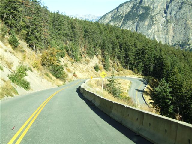 |
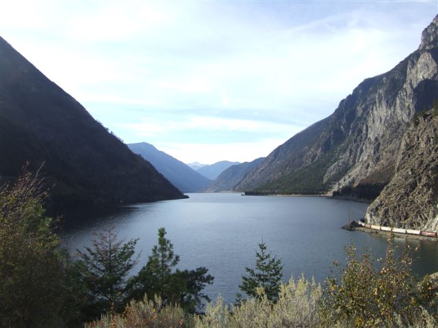 |
But there are lots of lakes and spectacular views. We are just coming into
Lillooet and our stop for the night. To put it all in scale, notice on the
right the train creeping along the lake edge. This one had six locomotives
on the front. This is not easy country. |
| The campsite was empty
and we were on the road again in the morning. The road in this part of BC is
quite spectacular and is why I wanted to travel it again. Note the clouds in
the valley. | 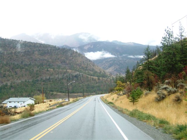 |
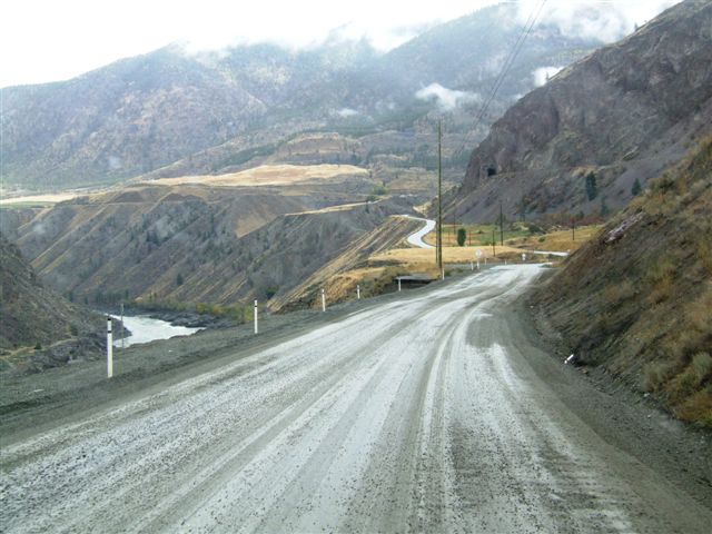 |
This bit you drive slowly, not that it wasn't a good road. The river down
below is the Fraser, one of the giants. |
| It is also quite high up
and you can lose visibility as you drive through a cloud. We start going
down soon. | 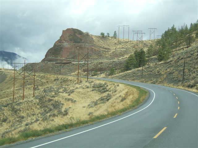 |
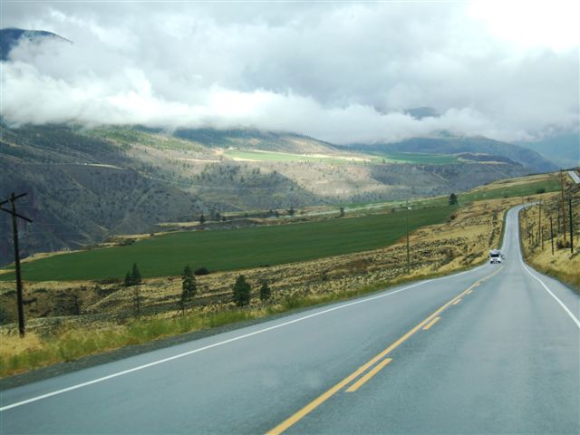 |
As we descend there are more signs of life, agriculture and greenery. They
were also irrigating the land which seemed odd given that it was raining at
the time. The RV approaching was one of the many rentals mostly hired by
Germans. |
| The road picks the best
route it can across the mountains and often shares space with the railway.
Endless streams of Chinese containers.... | 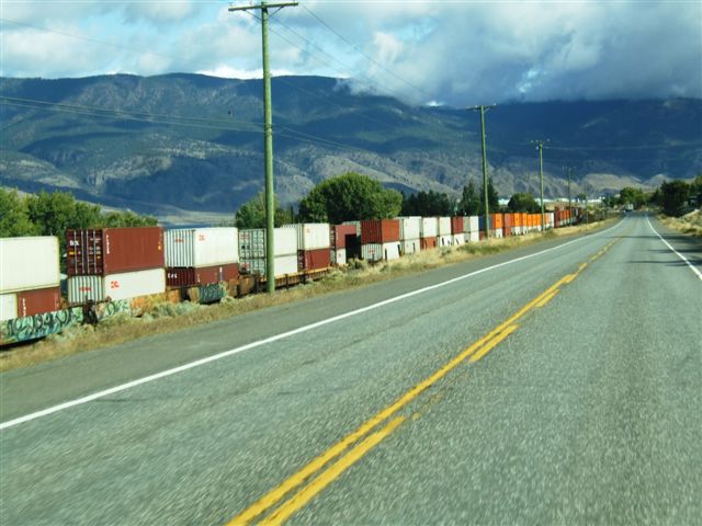 |
 |
We stopped overnight in Kamloops and then started to head south for Kelowna.
This is the Okanagan Valley which is very fertile and thus well populated. |
| We stopped briefly along
the way and spotted this globe which was celebrating a local hockey team
winning a championship. | 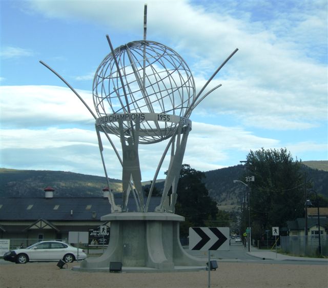 |
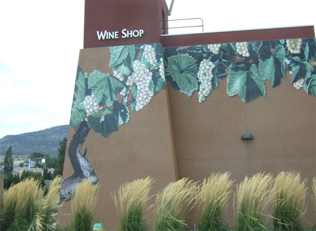 |
We stopped because we wanted some BC wine and the tourist centre was also a
wine shop and they were having a tasting. BC wine is very expensive (as is
all alcohol in Canada). $20/bottle is almost the minimum price. |
| It is a serious grape
growing area. These vines are less than a foot apart. The leaves have been
trimmed and the grapes are at the bottom. Interestingly the apples are grown
in much the same way. We are now at Oliver - only 20km from the border but
it's time to stop. | 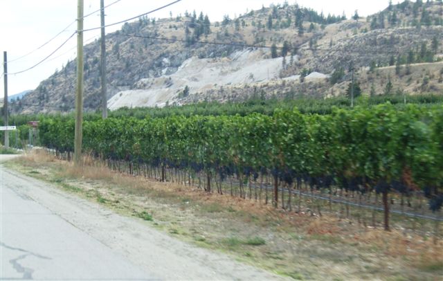 |
|