| From the campsite in
Blanding you start to see the mountains. These are Mount Linnaeus,Abajo Peak
and Shay Mountain. | 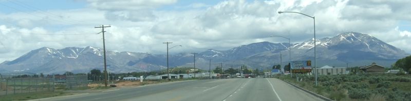 |
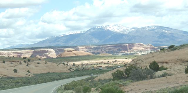
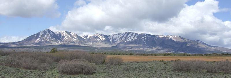 | At this time of year the snowline is still at around 9000ft.The road was getting up to around 7000ft. |
| As we head further north
and top each rise, there is another valley and more mountains. This is the
start of the Rockies although there are several different ranges which go to
make them up. | 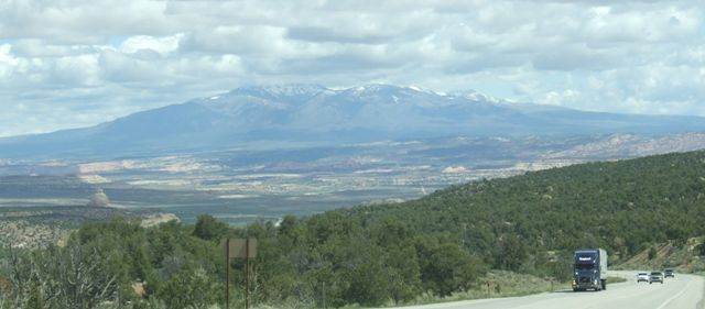 |
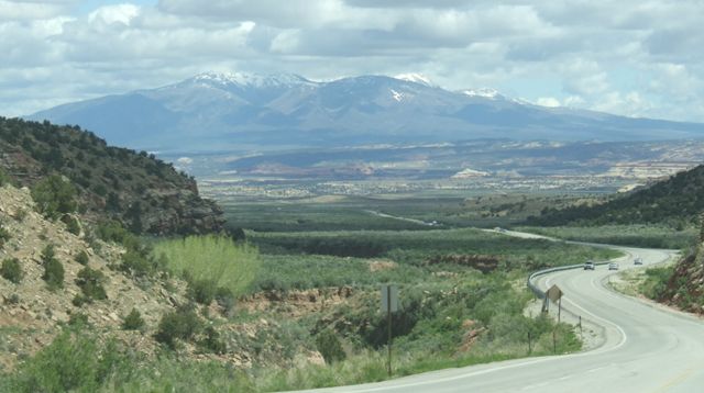 |
The scenes are very impressive although it is quite difficult to capture the
scale and the grandeur in a photo.. |
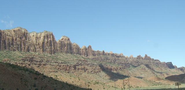
| Although we have left the
sandstone and the desert, there are still outcrops such as this hoodoo. We
are moving along the join between the desert and the mountains as we
approach Moab. | 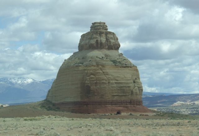 |
 |
This shows the presence of both formations. Here we are on the edge of
Canyonlands, a great tourist attraction for people with high clearance
vehicles who enjoy off roading, but otherwise very desolate and uninhabited. |
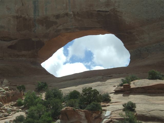
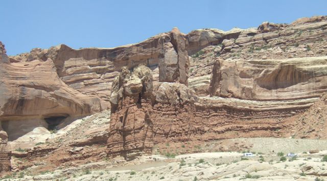
| At Moab is the Arches
National Park. We are still a little to the south but this outcrop shows an
arch in process of being formed. It will be complete in another 100,000
years. | 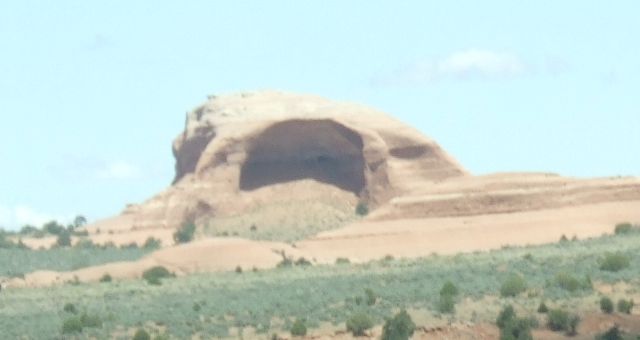 |
 |
Here is one I made earlier! This is Wilson Arch just to the south of Moab. |
| A few miles further on we
find a commercial site. We couldn't see the hole and didn't stop. | 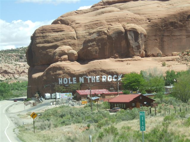 |
 |
Moab is a lot larger than we remembered with a lot of house building to the
south. The scenery makes a great view for the houses but I don't know where
the work is. |
| The cliff goes on for
several miles. Moab is situated in a valley. | 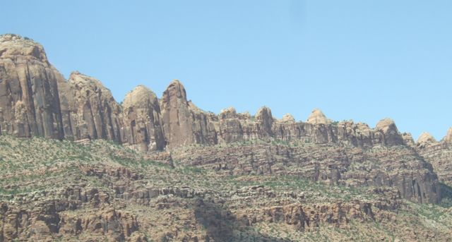 |
 |
The rock formations are amazing. But we have been here before in 2005 so we
won't be stopping long. |
| Further north we find
more evidence of minerals in the sandstone. The green may be copper or may
be iron. | 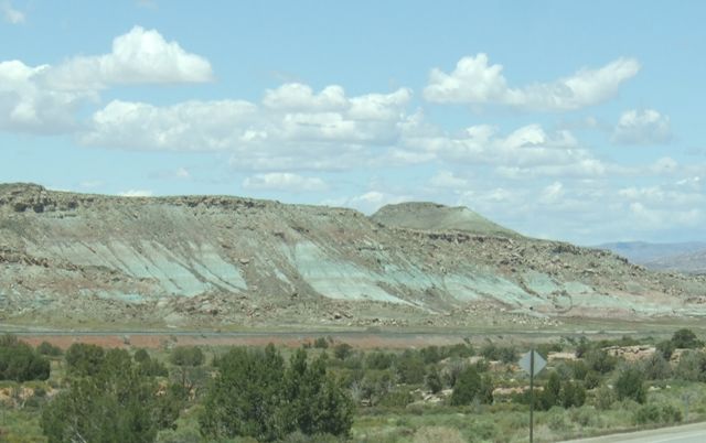 |
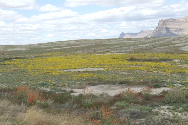 |
At this time of year the ground is blooming with a blanket of yellow flowers
and a ribbon of vermillion in the foreground. These desert flowers are on
miles of the roadsides we have driven along. |
| We are still driving
across an essentially flat plain (albeit at 5000ft). This part of southern
Utah is still unpopulated. I think this was close to the town of Price as we
start to move north west instead of west. | 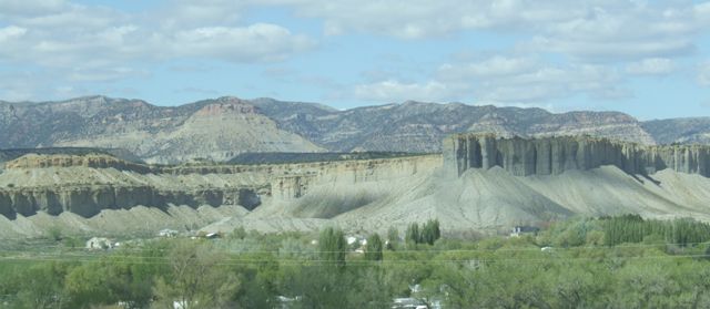 |
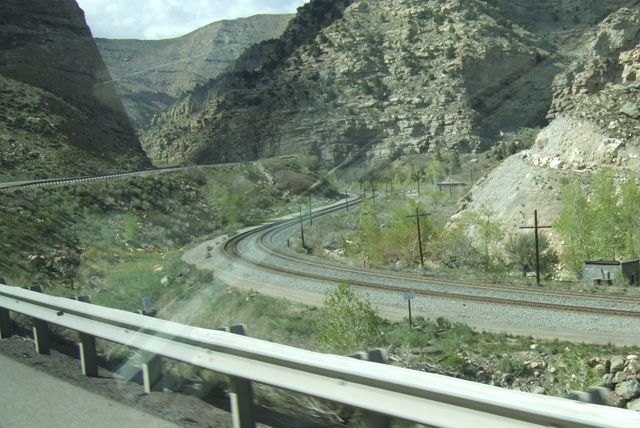 |
We picked up the railroad and started to climb towards Soldier Summit. The
road climbs for miles up to the summit at 7700ft. The railway kept alongside
the road. There were two, sometimes three tracks to handle the heavy slow
trains using this major climb. |
| There are major rock
formations along the way, but we are into grey rock now and not red rock any
more. | 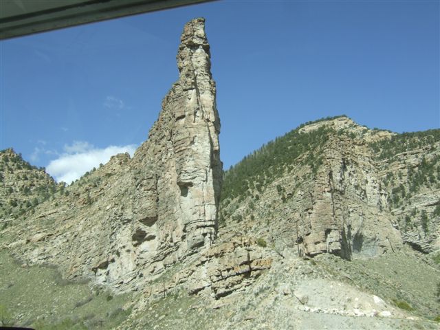 |
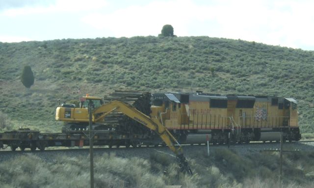 |
This is useful to a modeller in that it is a prototype for anything. There
are two locos with one flatcar with a tracked unit collecting old wooden
sleepers from alongside a track which has recently been relaid. |
| Close to the summit we
have remnants of snowdrifts alongside the railroad. | 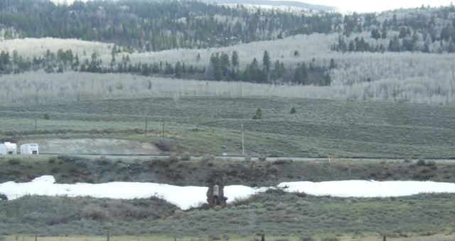 |
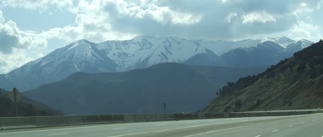 |
We are now seriously into mountain country (and incidentally on Mountain
time). |
| Most peaks still have a
topping of snow. In winter these roads are often closed and chains are
almost always required. | 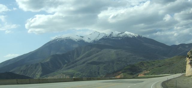 |
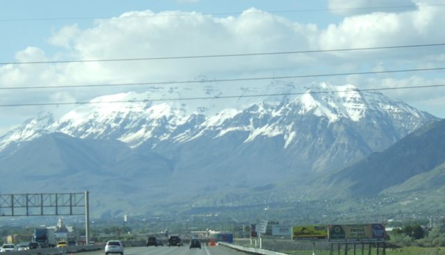 |
And so we reach the Salt Lake Valley. Here we approach Provo where we will
stop the night at a campsite we have stayed at in the past. These are the
Wasatch mountains. |
| Just before we reach
Provo we pass Springville UT, and are reminded of our original base in the
US in Springville NY which is near Buffalo and 2000 miles to the east of
here. | 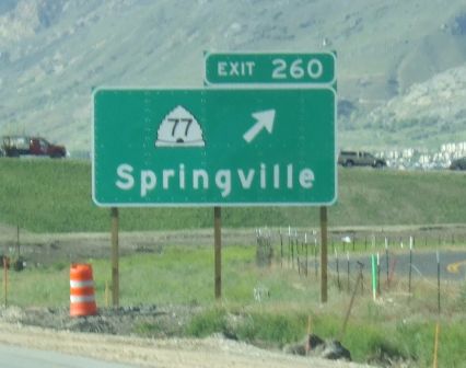 |
|