 |
From Grants/Milan we took the back road south into the Hopi and Navajo
reservations because it also has some interesting historical and geological
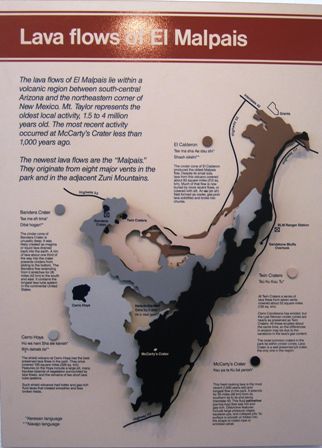
sites. The first is El Malpais where a series of volcanoes has deposited
lava flows. The most recent was around 1000 years ago. Nature is very slowly
recovering these lands and scientists are studying the process. The Zuni
oral history recalls the most recent event and the migration it forced on
their people at the time. |
| This whole area is pretty high and the US continental
divide crosses through this area. To the east water flows into the Gulf of
Mexico, to the west it flows into the Pacific. | 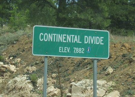 |
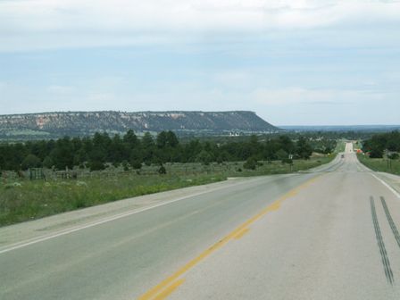 |
This is still fairly isolated country although the roads are good. The Zuni
and the Hopi tend to live on the top of the mesas (flat topped hills you can
see). These must be above 9000ft and get quite cold in winter. |
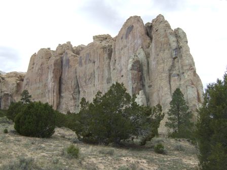
| This is a particularly important rock outcrop because
it has the only reliable water source for miles at its base and before the
railway came in 1880 it was a major stopping point in the Acomi Zuni region
for travellers. | 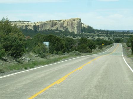 |
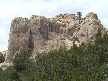 |
It is officially known as El Morro but is commonly known as Inscription
Rock. Today it is a national monument and protected and preserved for
posterity. |
| The sandstone has other minerals within it which lead
to the colour variations which can be seen towering above you. | 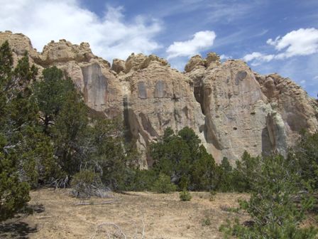 |
 |
There is a concrete path about one and a half miles long so that visitors
can be guided to the interesting parts and deterred from walking on the very
fragile soils in the area. |
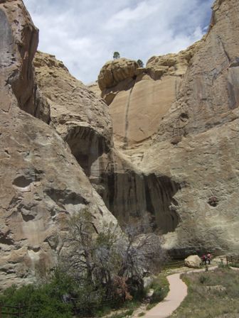
| This is the oasis which is partly shaded by the
overhanging rocks. The black markings are where the water seeping out of the
soft rock has deposited minerals over the centuries. The pool varies in
depth through the seasons and a measuring stick showed that it was currently
10ft deep which is not bad as the rainy season is just about to start. | 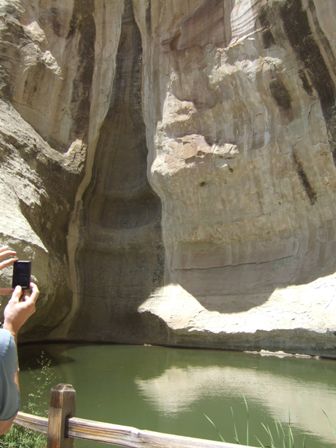 |
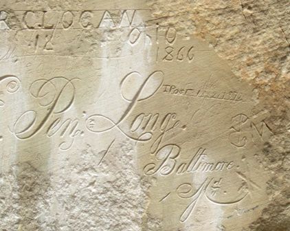 |
The modern attraction is not the pool but the inscriptions left by
travellers over the years. The earliest is by the Spanish Governor Don Juan
de Onate in 1605. This one is much later (1866) and the ornate script was
carved by army engineers laying out routes to open up the west. Their group
was led by Lt Beale who was also testing the usefulness of camels in this
terrain. |
| The soft sandstone encouraged many people to leave
their mark. Today it is prohibited by law to add to them. | 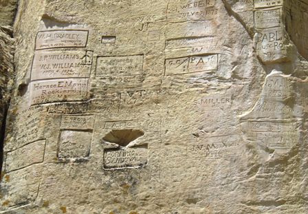 |
 |
But in the past the distinctive shape of this outcrop must have been a
welcome sight knowing there was water at its base. |
| Looking out from the rock reveals a pretty desolate
landscape with only scrub and mesas for miles in any direction. | 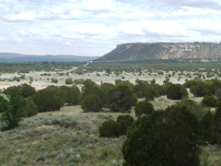 |
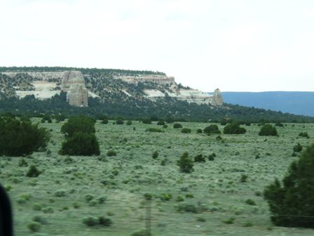 |
Although it looks green and lush, this is largely an optical illusion. You
need about 20 acres to support a cow out here. |
| We travelled through Ramah (a Navajo town) and turned
back north just before Zuni and headed into Gallup, back on the interstate
where we stayed overnight. This is actually a statue outside the fire
station. | 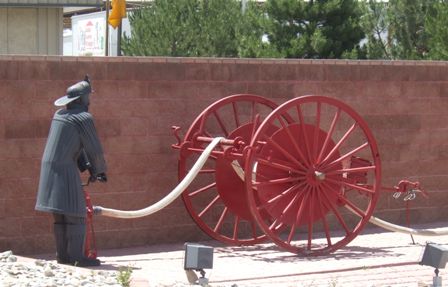 |
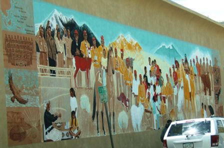 |
Rendered walls create a good surface for murals and we often see paintings
on the wall. The whole state is very supportive of artists. This was
probably painted by a native American given the subjects in it. |
| We've seen a few very large pots like this one (at
least 8ft tall). The painting style is similar to that we saw in northern
Mexico and is probably inspired by native traditions although this is much
more recent. | 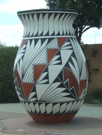 |
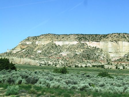 |
The following day we continued on the interstate (I40) now heading for
Flagstaff, AZ. We are still in a desert sandstone landscape and still quite
high up. Flagstaff is at 7000ft. |
| The road is parallelled by the BNSF main line and we
saw dozens of long container trains in both directions. | 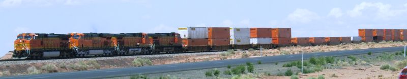 |
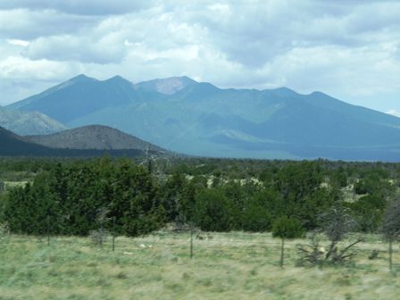 |
These are the San Francisco Mountains, at over 12,000ft, the highest in
Arizona. They tower above Flagstaff where we are heading. |
|