Eventually we reached Colorado Springs and camped out on the road to Manitou
Springs. We had been watching the Rockies slowly ascend for about the last 100
miles with the snow capped top of Pikes Peak being the first to appear. We can
but guess what the impact of seeing this mountain range must have had on the early
settlers.
Pikes Peak is the highest mountain in the US with a road which goes right to the
very top. We thought (naively) that we would try to do this on the scooter. We
started at 6000 ft and made it up to 8500ft. At this point it became apparent
that both it and we were beginning to suffer from the lack of oxygen in the air.
At the summit (14100ft) it is only 58% of that at the base. The road up is 19
miles long but it doesn't start until 15 minutes from town. (Americans measure
distance in minutes - by car at 60mph). The scooter only has a range of about 50
miles (and a lot less at 8000+ft). For a car the rangers advise 80 miles of fuel
for the 19 miles. Besides, by Crow Gulch we were down to 15kph and no, we
couldn't have walked faster!
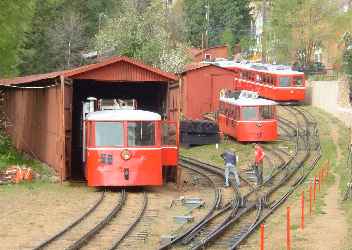
| So we decided that discretion was the better part of valour and
took the 9 mile cog railway to the top. Even this takes 80 minutes with
grades up to 25%. This used to be steam hauled but these days uses very
efficient (and quiet) Cummins diesels. |
|
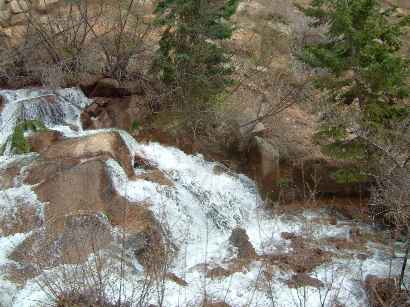 | The
track starts by following the creek valley and there are numerous small
waterfalls to be seen from the cars as you rise steeply from Manitou
Springs. |
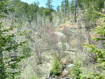
| At various points there are whole clumps of trees which look
dead. That's because they are! The prime culprit is a beetle. They can't
spray for it because of the potential damage to the water which filters
down to the many spa type springs in Manitou Springs. So they hope for bad
weather in the winter to kill the beetles. Sometimes it does, and
sometimes it kills the trees too!
The conductor on the train was quite a comedian: "Look over there
in the distance - that flat bit is KANSAS". |
|
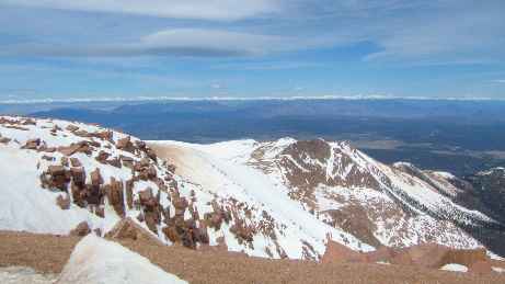
| The view from the top is breathtaking! Literally! This was a clear
fine day with temperatures in the high 60s at the base. At the summit it
was a "warm" 26 F without the wind chill factor and
6 F with. Hot chocolate brought new pleasures!
That row of snow capped hills in the distance (snow is only present
above about 12500ft at this time of year) stretched from North to South as
far as the eye could see. Their nearest point was about 80 miles and the
horizon was over 120 miles. |
| It may be my imagination but I was sure that I could see the
curvature of the earth. The land is still essentially flat as in Kansas
but the mountains are just sudden uplifts out of the plain: the geological
divide. | 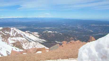 |
| The mountain is named after the leader of an expedition that tried
to get to the top. They were foiled by the weather, and Pike never
actually reached the top, so the peak is named after a failure.
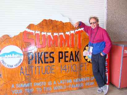
Sometimes you just have to do the tacky touristy bit. So here you are
just to show that we did it! |
|