| Although the campground is in the hotel car park it
was very pleasant, and very quiet when the weekend visitors went home. We
had our own showers and toilet and the beach is only 50 yards away. We have
actually found that a number of the campgrounds are attached to hotels/motels and
they have generally been at least reasonable. But this will be our last
sight of the sea as it is now time to turn inland. | 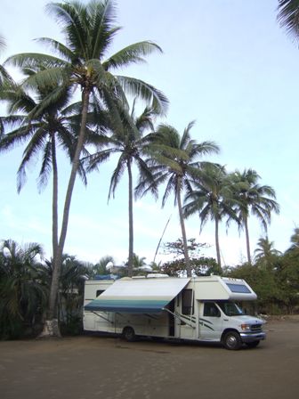 |
 |
Having driven down the Mex 200 for so long we thought we would give the
ordinary road up into the mountains a miss and opted instead to go via the
new toll motorway Mistake! We got lost trying to navigate through Lázaro
Cárdenas and had to retrace our steps
for miles, running into this along the way. We must have gone over a hundred
topes as well. |
| Eventually we found the bypass (completely unsigned)
and headed around the city passing this lake, which turned out to be a
reservoir. | 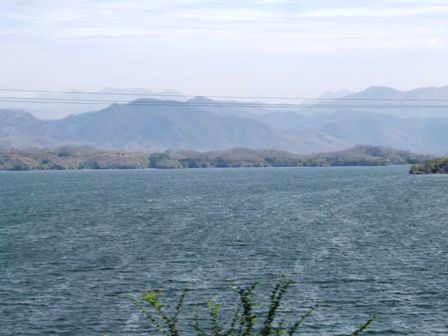 |
 |
Which we discovered as we went over the dam, being waved on at the army
checkpoint halfway across. This is about the tenth army checkpoint we have
been through but we have only been stopped once. Then I think they just
wanted to look inside out of curiosity. |
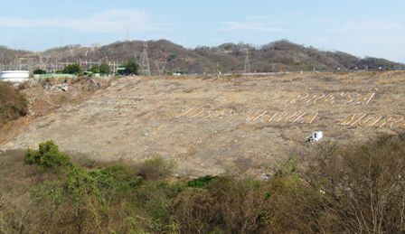
| Below the dam is the power station. There seems to be
quite a lot of hydroelectric power generation in Mexico. | 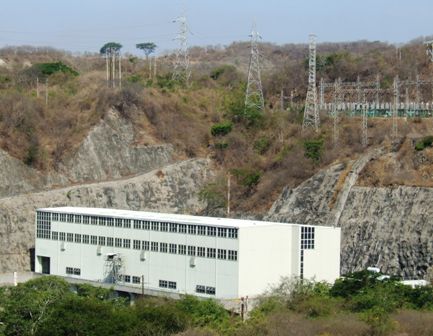 |
 |
Eventually we found the motorway, one lane each way but you do have a hard
shoulder before the rain gutter. This is bliss after the eight foot way we
have been travelling! AND almost no topes! |
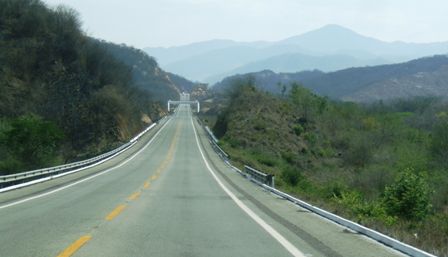
| This is the Mex 37D (most toll roads have a D). It is
a new and very impressive road which crosses the Sierra Madre Del Sur
mountains as it makes its way up from sea level to 7000ft. This is a brief
downhill stretch. | 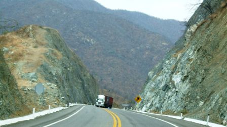 |
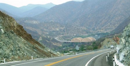 |
And the view as you get round the bend! We crossed lots of bridges like the
ones here but came across very few towns and villages even off to the side.
There is a section of maybe a 50km with no exits. |
| The road actually follows a valley which has a river
in it which has been dammed so there are several power stations along the
way generating over 3000MW. | 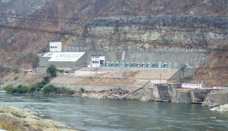 |
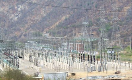 |
These have equally impressive switching stations associated with them,
presumably to raise the voltage to reduce losses as it is
transmitted to the cities all of which are a long way from here. |
| A lot of the valley has been flooded to create the Infiernillo lake. This is the border between
the states of Michoacán and Guerrero. The
latter is a poor and relatively empty state whose main city is Acapulco, on
the coast some
200 miles to the south. | 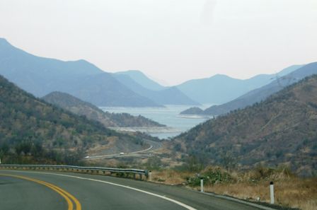 |
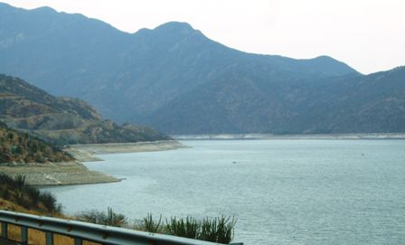 |
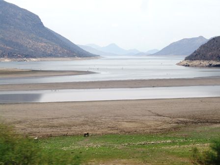
We are at the end of the dry season and the summer rainy season is due any
time. From the looks of the water levels it is overdue and will be very
welcome. |
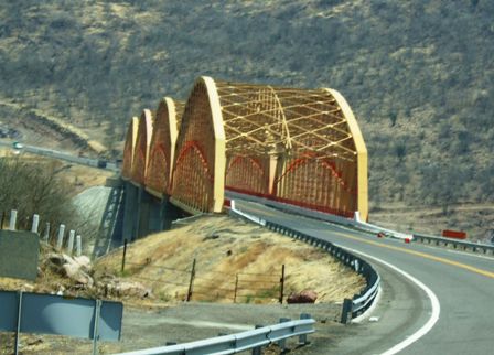
| This is one of the longer bridges made up of four
sections. They are all painted the same colour which really brightens up the
scenery. | 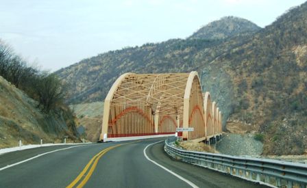 |
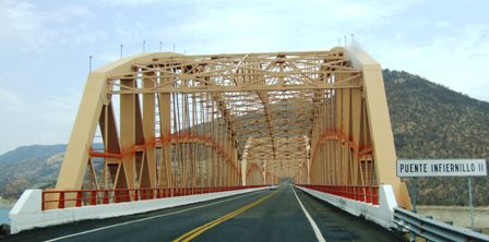 |
All the bridges have names (even the one called 'Puente sin Nombre - bridge
without a name!) |
| Further up the valley there were islands in the middle
of the lake, but you can still see where the water level should be. | 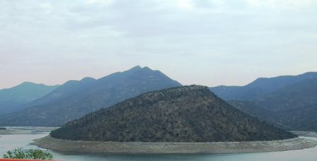 |
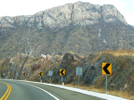 |
Occasionally the rock formations are quite spectacular although they are
always high above you. They do like to warn you about bends. It's a pity
they can't tell you where the road goes to occasionally. |
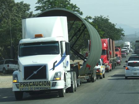
| No, the truck on the front of this is a full sized
semi with a full length 50ft trailer, so you can work the rest out for
yourselves!. | 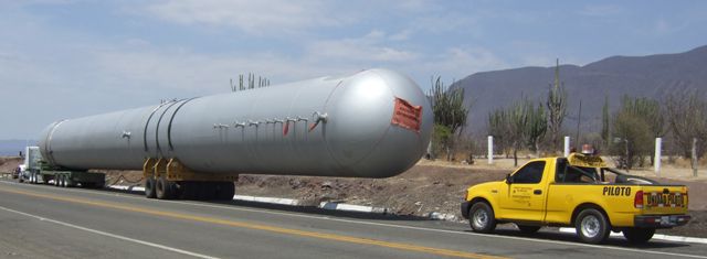 |
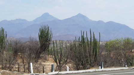 |
As you go higher the vegetation changes. These cacti only seem to flourish
within a fairly limited altitude range. |
| Here the lake is even shallower with sandbeds
appearing. The railway has now joined us having followed the old road for
the first 100km out of Lazaro Cardenas. We have heard a few trains but not
seen many. | 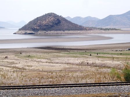 |
 |
This lake is actually huge and floods two valleys, each for over 80km and up
to 12km wide |
| It is a long and empty road heading north for the town
of Uruapan where it joins the 15D that we have travelled before and then
turns east towards Pátzcuaro and Morelia
and eventually to Mexico City. | 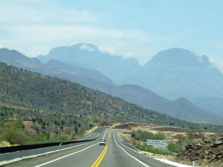 |
 |
More bridges as we cross from one side of the valley to the other. |
| Finally we reach Pátzcuaro
which sits beside a lake. Many smaller communities live around the lake and
some even on the islands on the lake. This is Isla Janitzio, a Mexican
version of Mont St Michel, and famous for the festivities on the Day of the
Dead in November. | 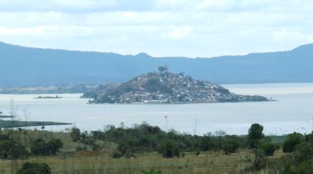 |
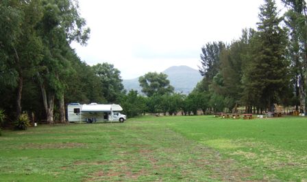 |
And so to yet another empty campsite where we have the pick of the spaces.
The only snag with this one was the train which runs across the entrance (at
0330hrs) Scared the day(night)lights out of Jan! |
|