| It is 12 miles from the
entrance to the park, down by the main highway, to the visitor centre from
where you choose which mesa and ruins to explore. The road first climbs all
the way to the top of the mesa (which is Spanish for table). The views are
spectacular. We have just travelled along the road curving through this view
to get here. | 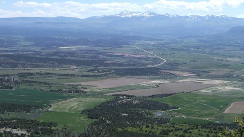 |
 |
But the distances are quite difficult to portray in the photos. The
horizon is probably 50-70 miles away but air quality is rarely good enough
for real clarity. Much of the road up has a very steady grade as you can see
here looking back across the flank of the hill we have just climbed. |
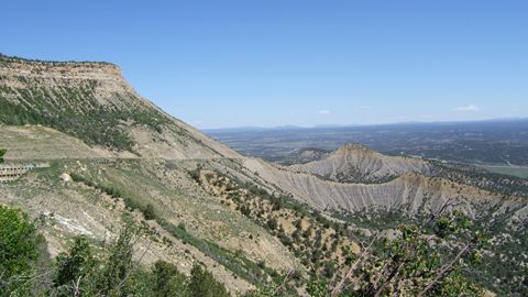
| There are many turnoffs
where you can stop and study the view. The vertical face on the right is
known as Knife Rock. It looks as though it is being guarded by a massive
stone turtle. There are snow-covered mountains on most of the horizons. | 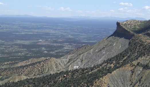 |
 |
But they are often quite difficult to see in the haze. We spent two days in
the park and the second was much more overcast. The views were even more
limited then. |
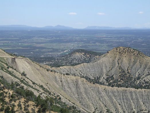
| The tree is a reminder
that the park has had a number of wildfires in recent years. Over 70% of the
park has been affected at some time as we will see later. | 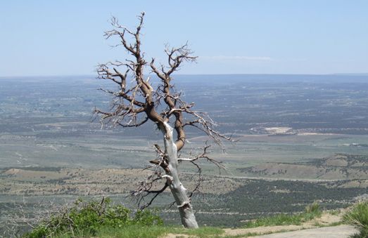 |
 |
There are two main mesas within the park, each with its own road from the
visitor centre, but one was not open to us because the RV is too long and
too heavy. The people who lived here are now known as Ancestral Puebloans,
the name 'Anasazi' no longer being considered politically correct. We went
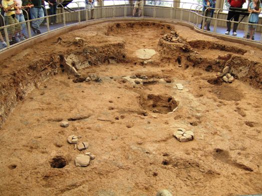
round the Mesa Top Loop first. There are several sites here in chronological
order starting with early pit houses which were built by the 'basket
makers'. These are little more than shallow depressions in the ground but
they would have been covered when occupied. The biggest depression would
have been the fireplace, the four holes in a square around it would have
held the poles that supported the roof. These houses date from around 700AD. |
| Successive sites cover
later periods as the pits became slightly deeper and more details survive.
This one had internal walls. Most pits follow the same design. The pits you
can visit are all covered today with steel shelters to protect them from the
elements. This one dates from 900-1100AD. Some reuse was made of earlier
sites. | 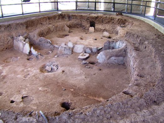 |
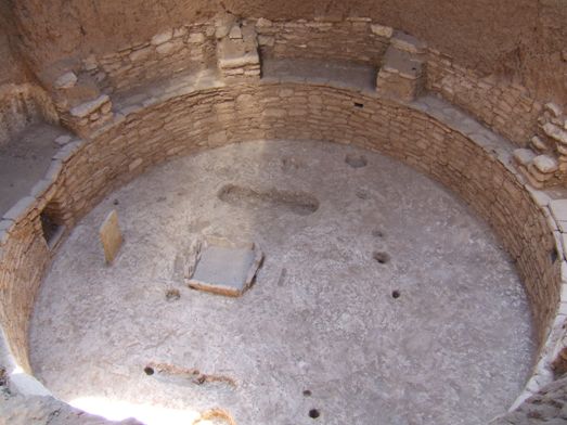 |
As time progressed stonework was introduced and the buildings became deeper.
Each family built its own room for ceremonial occasions. This is known as a
kiva. Wooden poles rested on the stone pillars with more poles on top of
these to create a roof, the gaps being filled with clay. Entry was by a
ladder through a hole in the centre of the roof. The hole in the wall on the
left is connected to a shaft through which fresh air comes. The stone in
front of it deflects the air to create a draught to take the smoke from the
fire pit near the middle up through the entry hole. Either side of the fire
are depressions for foot drums. The smallest hole directly in front of the
fire is the 'sipapu', the access for the spirits to and from the lower
worlds. |
| Around 1100AD many of the
houses were built of stone, both above and below ground. Some of these were
quite large complexes with many rooms. This one is from the megalithic
period, so called because of the use of 'big stones'. | 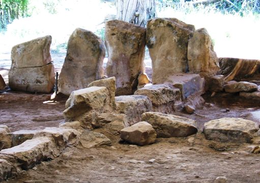 |
 |
A number of canyons wind their way into the table mesa. These enable us to
see the alternating layers of sandstone and shale. |
| The scale of these is
huge. The canyons are up to 2000ft deep. These are very inaccessible areas
both from the canyon floor and from the mesa top. | 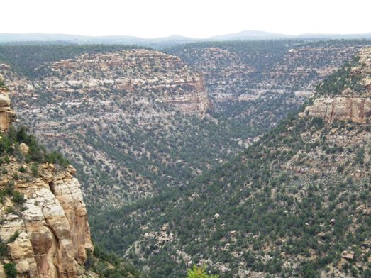 |
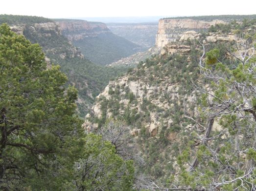 |
It looks very inhospitable but the mesa top was, and is, a very fertile area
with 7-10ft of good quality loess topsoil. The whole mesa area slopes gently
towards the south, thus receiving more sunshine and warmth than the
surrounding plains, and it attracts clouds so more rain falls here than
lower down. Since the Ancestral Puebloans were farmers this is probably the
main reason why they chose to live up here. |
| The sandstone is at the
top with grey shale underneath. As rain falls it seeps slowly through the
porous sandstone but when it reaches the non-porous shale the latter breaks
up over time and is washed out (a still continuing process), creating
covered ledges which you can see just below the mesa top. |  |
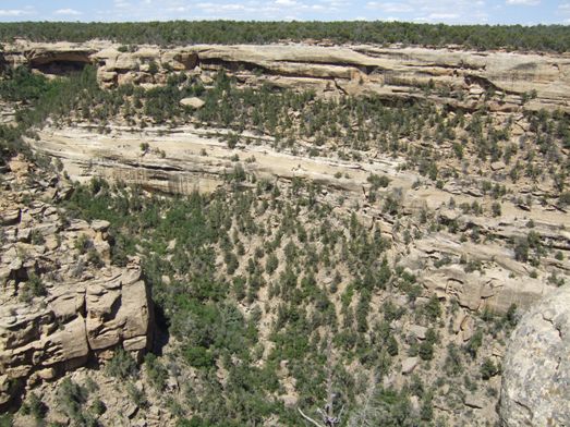 |
The best example here is on the left hand side but there are over 700
archaeological sites within the park. |
| Under the sandstone roof
you can just see the shape of some buildings. These were first spotted by
cowboys chasing lost cows in 1921. | 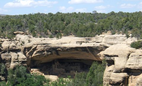 |
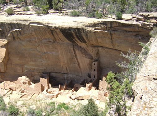 |
On the mesa top loop we were able to look at over a dozen sites on the
opposite site of the canyon. There are living spaces, storage spaces,
ceremonial spaces, round and square towers. |
| There are three separate
little communities here on different ledges. The trees on the top were all
burned in a fire in 2003. It is unknown why the Puebloans moved off the mesa
top onto the ledges but it is not thought that aggression from other tribes
was a reason. It may be that more land was needed for agriculture to support
the growing population. | 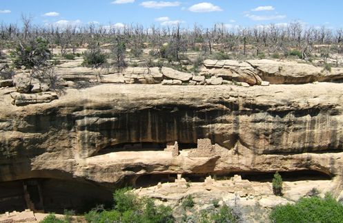 |
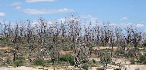 |
Another shot of the burned trees, mainly Utah and pinyon
pines. They have tried reforestion in other parks with little success. Today
it is thought best to let nature take its course. It may take 400 years for
the area to fully recover. |
| But it does happen as can
be seen in this area which was burned in an earlier fire. The trunks still
remain but the green shrubs are now recovering. | 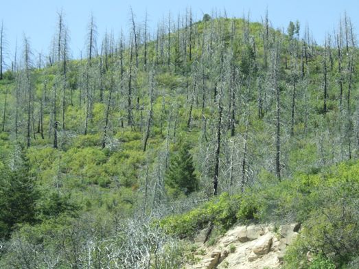 |
|