| This is the St Louis skyline with the "Gateway to the
West" towering 630 ft over the city and a very impressive sight. The
river in the foreground is the Mississippi which flows straight through
the middle. On the other side of the river is East St Louis which is in
Illinois. Now St Louis is an important town in Missouri and so warrants
its own street map. East St Louis is not so important to Illinois and so
doesn't. | 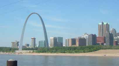 |
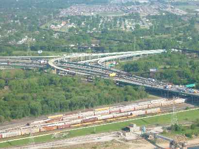 | Unfortunately
neither state considers that a map of the total city might be useful so
the street map stops at the river. The photo above is taken from our
campground - on the Illinois side. And to get to it we had to negotiate
this (and several other) interchanges. Small wonder then that it took an
hour and a half and three river crossings.
Note also the railway tracks in the foreground and background. Yes -
once again I've found a campsite in a marshalling yard. |
| The City Hall was quite imposing and not a skyscraper. Perhaps in
Missouri they spend the money on grander statements like the arch. However
this was just one of several attractive buildings we found, both tall and
short. Again we were surprised by the lack of people and cars in the city
centre. They were all obviously too busy populating the freeways. | 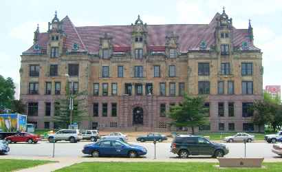 |
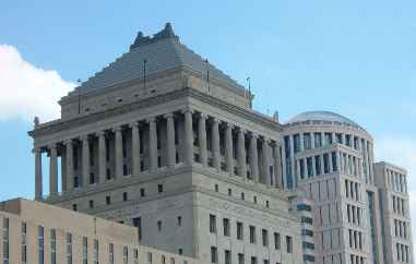 | A peculiarity of the
architecture was the number of pretty tall buildings with huge colonnades
perched hundreds of feet in the air. These are at least twenty stories up.
Very imposing but we do wonder why they are there. |
| The Arch towers above everything in the city and leads to some
interesting photo opportunities. The plaza behind this statue was hosting
a South American event with stalls, drinks and food. We had a
"fishbowl" margherita and felt the effects all afternoon. | 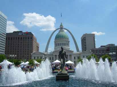 |
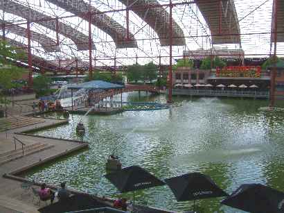 | Seeing Union
Station on the map we just had to pay it a visit. The outside partly
looked like some Italian churches we have seen. Like the station in
Chattanooga, the building is now a hotel but with a sizable selection of
shops and cafes on the first two floors, plus open areas like this boating
pool. In actual fact the last trains left in 1958 and it languished empty
and derelict for a number of years before being tastefully adapted to its
present purpose, but with many of the architectural features retained. |
| We had tried to go up the Arch in the morning (it has an internal
'tram') but they had sold out tickets for the day at 1030hrs given that
they had 1700 pre-booked schoolkids (it's school trip time). However they
later reopened the second tram that had been closed for maintenance so we
went up to see the spectacular view. The first photo of the interchange is
looking east and this one faces west. Well worth our detour 400 miles
north from our original route and two nights in a casino-based RV park
next to a railway yard and several freeways. | 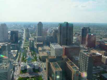 |
|