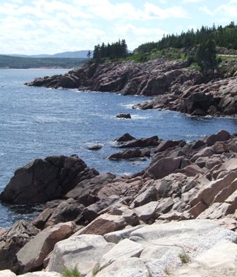
| So we left Cheticamp behind and headed north into the
Cape Breton Highlands National Park on the Cape Breton Trail. This road
follows the coast around the north west corner of Cape Breton Island. It
gives a succession of clifftop vistas as you follow one bay after another. | 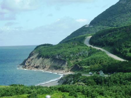 |
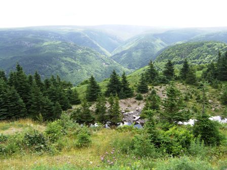 |
There are no roads on the inland side, just one of the last remaining
untouched forest areas in Cape Breton. This is home to bear and moose. We
did catch a quick glimpse of a black bear crossing the road in front of us.
This complemented the young moose we had spotted running through someone's garden
in Cheticamp. This is the George River valley where the rocks date back over
900 million years. This plateau is regarded as geologically dead because the
rocks are now too hard to erode further. |
| The road climbs up at the headlands and then falls
away to sea level for the villages which nestle at the river mouths. | 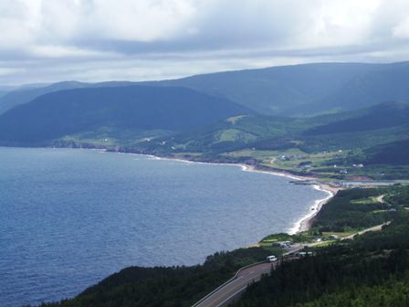 |
 |
Surprisingly there are sandy beaches at the sides of the small harbour where
the small fishing communities still manage to eke out a living. Whale
watching tours also go out from the larger harbours. |
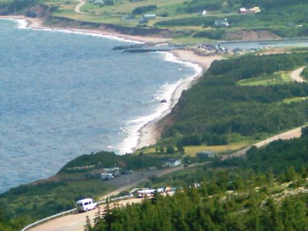
| After every headland comes another bay. Whales can be
seen from the headlands. We watched the boats but didn't spot the whales. We
got diverted into watching an eagle instead. |  |
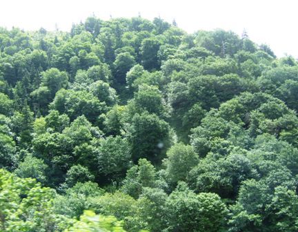 |
When the road does leave the coast you just have trees - and more trees.
This is an old mixed hardwood forest. We just love the texture that clothes
the hillsides here. |
| The road follows the sea up the west coast then cuts
across the top of the peninsula, where there are no roads whatsoever, before following the east coast southwards. | 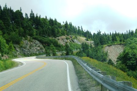 |
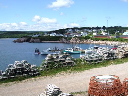 |
We stopped at a picturesque fishing village at the top of the peninsula
called Neil's Harbour. We parked by the lobster pots and wandered for a
while. |
| There were a number of small fishing boats moored and
watched over by one of the many lighthouses along this coast. | 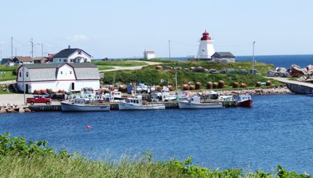 |
 |
No sand along this area, rather rocks down to the water's edge. It explains why
the lighthouses are so important along this coast. |
| More bays as we head south down the inlet. On the west
coast we were facing the Gulf of St Lawrence but this is the real Atlantic
Ocean. | 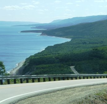 |
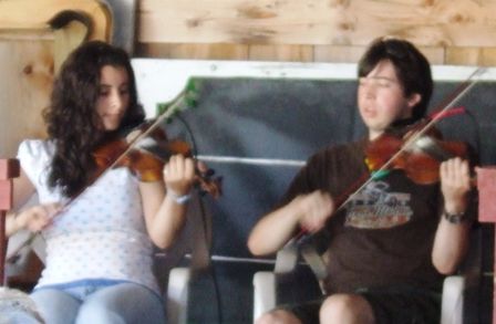 |
We came to the end of the inlet and continued south to Whycocomagh where we
camped. The campground has a large covered area where an impromptu music session took
place. The girl appeared to be the driving force in the Cape Breton fiddling
but the lad was possibly technically better. Here he is keeping a
close watch on what she is playing. |
| The last time I saw a pole instrument like this was
with John Kirkpatrick. This musician turned up in a car with a plastic hand hanging out the
boot to the amusement of all. We got invited to a real Cape Breton dance
that evening. This was the real thing rather than something just for the
tourists. We travelled about 20 miles down dirt roads to a hall in the
middle of nowhere. There were
about 120 people with four musicians taking turns on the keyboard and
fiddle, including the lad seen above. He was good. The dancing
was similar to an Irish set and they only had THE dance: a set of three
simple figures. It was much less structured than we are used to and the set was
danced numerous times. It was obviously a local social event for the local
community but enhanced by the 'snowbird' community from the area. | 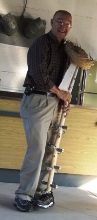 |
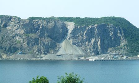 |
And so we left Cape Breton Island and returned to the Nova Scotia mainland.
This quarry is just on Nova Scotia. The tiny dots at the bottom of the cliff
are quarry trucks! |
| The road bridge we crossed has a lifting
section to allow boats through. A railway bridge runs alongside it
but it is not clear how much use is made of it. I suspect it is used to transport
freight destined for Newfoundland via the port at Sydney. | 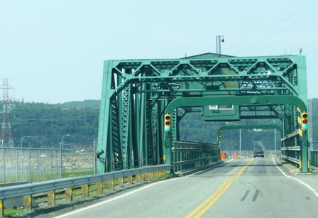 |
|