| We travelled to Sleeping Bear Dunes national park on
the north west corner of the Michigan lower peninsula. We camped there for a
couple of nights and took a day trip out. Along the way we found the Pierce
Stocking scenic drive which included this covered bridge. The reason so many
bridges in the northern parts of the US are covered is that it provides
protection from the extreme weather for the bridge itself. It is much
cheaper and easier to replace the bridge cover than the bridge itself. | 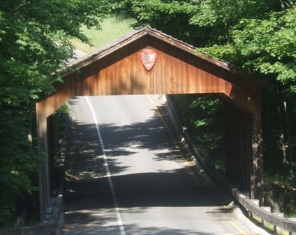 |
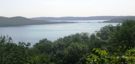 |
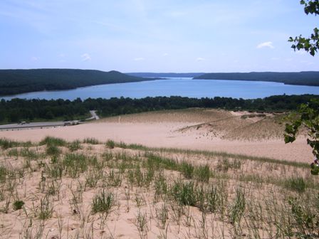
At one of the viewpoints we were able to look over Glen lake. There are two
parts to the lake. The near part is Little Glen lake and is only 3.7M deep.
The far lake is Big Glen Lake; beyond the sand bar, road and bridge, it is
about 40M deep. The lakes are separated from Lake Michigan by more sandbars. |
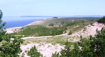
| The artist is looking out at Pyramid point and
Sleeping Bear Bay. We are stood on one of the tallest dunes which is 61
metres high. The dunes are constantly shifting. | 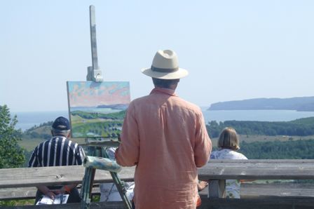 |
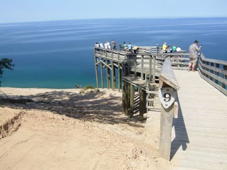 |
The dunes have a very steep drop down to the shore which is why they built
this ramp to help you look down. In 1995 a 1600ft stretch of these dunes
fell into lake Michigan. Similar events occurred in 1971 and in 1914.
Scientists are still trying to fathom out why such things happen. They all
happened in unseasonably warm weather during winter months. |
| The view is quite spectacular. A few hardy souls do
slide down to the beach over 100ft below but it is a heck of a climb back. | 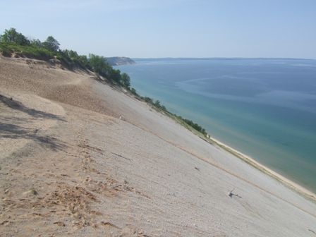 |
 |
This is the view of the Sleeping Bear with the North and South Manitou
islands in the background. The Indian legend is that a mother bear and her
cubs were driven into the sea by a forest fire in Wisconsin. They swam for
hours but the cubs tired and drowned within sight of the shore. The mother
bear finally reached the shore and climbed to the top of the bluff to watch
for her cubs. The Great Spirit created the islands as the cubs and the dune
as the mother. It is over 2000 years old and used to be over 70m high. Today
erosion has reduced that to less than 30m and it is continuing. |
| This is the time of year for the monarch butterflies
and they are very common around here. | 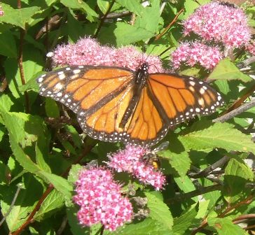 |
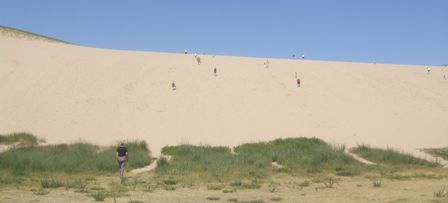 | A
bit further on there is Dune Climb and we decided it was time for some
exercise, although I nearly gave up before I reached the top which is about
twice as far and high as you can see here. |
| From the top you can look over the dunes to the lake
about 3 miles away. There is a walk but it is very hard going as the sand is
very soft. | 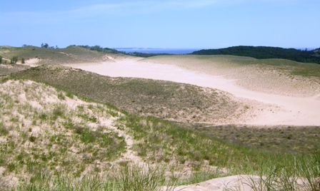 |
 |
Looking the opposite way you can see Glen Lake and halfway down the left
hand side is the car park so you can see how far away it is. At least it is
all downhill. |
| Up at the northern point is a coastguard station and a
maritime museum. This tree provides some shade and I just liked the shape. | 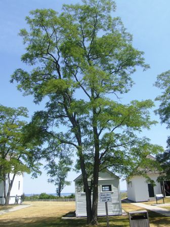 |
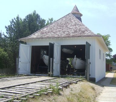 |
The Coastguard Station has two surfboats although neither are used today.
The boats ran on wheels down the rails and would have launched straight into
the lake. The station was built in 1901 and was almost buried by the
shifting sand. In 1931 the station was moved by horses. It was closed in the
1940s. |
| The boats are now filled with memorabilia and items
used by the teams over the years. There are also examples of breeches buoys,
Lyle cannons (used to fire ropes out to ships) and other tools used to
rescue people from boats grounded on the shores. | 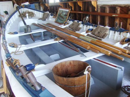 |
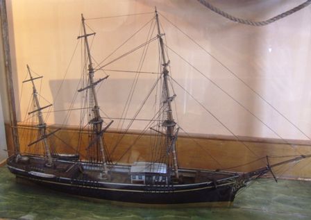 |
The Coastguard house has more museum items and models like this sailing ship
from the turn of the century. |
| Yet another Fresnel lens, this one is a fourth order. | 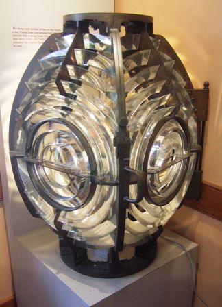 |
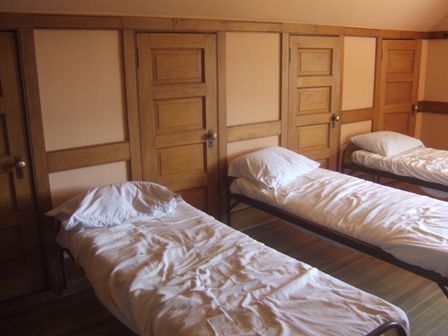 |
The crew slept on site in a bedroom upstairs. There were seven beds and each
one had a locker giving a personal storage space under the eaves. |
| The room next door was set up to show a wheelhouse on
one of the early lake steamers. | 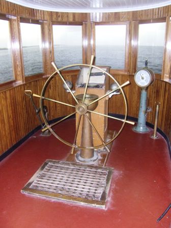 |
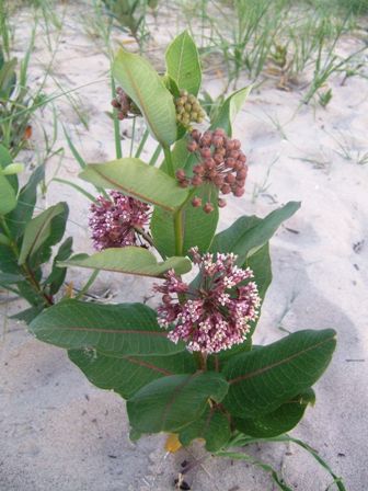 |
We walked out from the campsite to the beach along an old railroad grade
probably used to move logs to the lake. The dunes are a fragile environment
but there are many different plants to be seen even from the path. |
| Jan had to get her feet wet. Although there isn't a
tide, there is a little bit of movement over the day. | 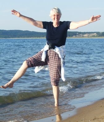 |
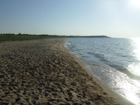 |
It is 80 miles across Lake Michigan to the Wisconsin shore. This means that
you can see the sun set over the water and it explains why the coast is so
popular (and why we had trouble finding camp space). We sat and watched
the sun go down which took much longer than we expected. It finally set at
2131hrs. It was only the day after the longest day of the year. The photos
actually look more impressive than the reality. It probably reflects the air
quality. Really good sunsets actually need impurities in the air to reflect
the colours. |
|