| The following morning we took the road out of Zion following a different route to the one we came in by. The canyon is still
impressive as we take the road away from the scenic drive and climb up out
of the
canyon. | 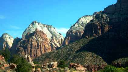 |
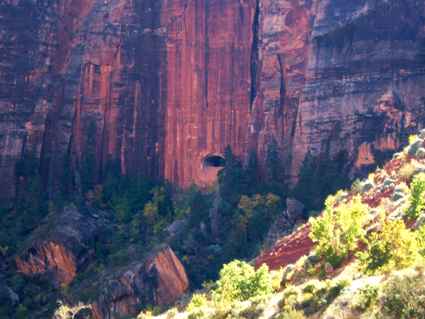 | This route goes
through a mile long tunnel which has a few side openings like a gallery. You
can just see one in this picture just below the middle. The tunnel was cut
in the 1930s and is not quite big enough for today's RVs. So they operate a
one way system when RVs want to go through and charge you $15 for the
privilege. Not bad when you consider how many miles the alternative route
would be. |
| Just before you reach the tunnel you have a view of the Great
Arch. This is where water and erosion are cutting away at the base of the rock. In
time this will be a perfect arch which you can see right through - if it
doesn't collapse first. It will take a little while though..... | 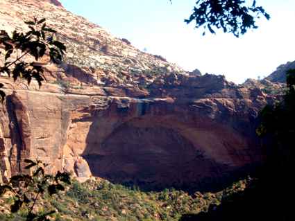 |
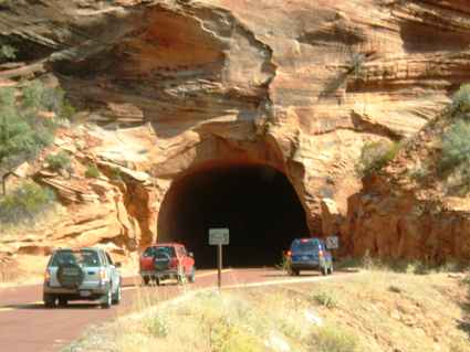 | There are a couple of
other short tunnels and with an RV you have to drive down the middle of the
road. The shoulders are only about 10ft above the road. |
| The rock formations on the other side are different, being made
from a thicker mud which seems to have slumped as it dried. | 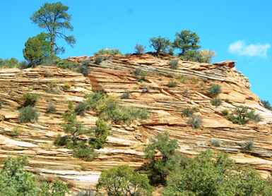 |
 | Trees have managed to
find cracks to put their roots into and these also assist with the erosion
process. There is a wide variety of reds and browns and yellows
interspersed with whites and greys. |
| Every curve in the (twisty) road provides another rock formation,
slightly different in colour and shape to the previous one. | 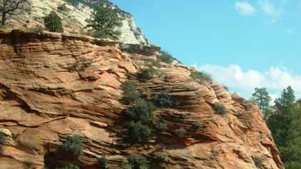 |
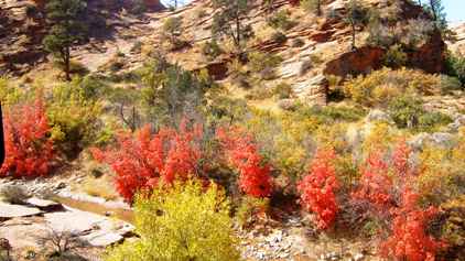 | Some of the bushes
have fall colours too as they prepare to shut down for the winter. This can
lead to some spectacular shows in the valley. |
| There was one area which was particularly vivid. The park was
just on the point of closing. Snow was expected daily and they do not plow
many of the roads so some will be closed almost continuously from late
October until May. However the main road to the canyon from the south remains open. | 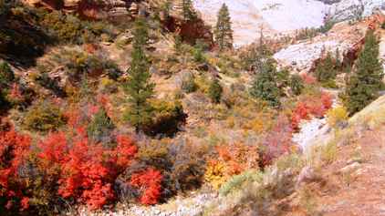 |
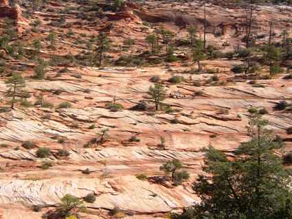
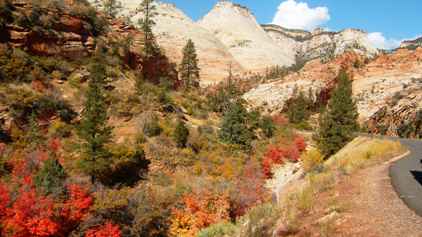 | It is a fair way from
the tunnel to the park exit and this was the sort of view for much of it. |
| Just before the park exit was an area known as Checkerboard Mesa.
Here unique patterns have been left as erosion by temperature and water has
etched vertical lines across the horizontal strata formed by the seas drying out, leading to this
hatched effect. | 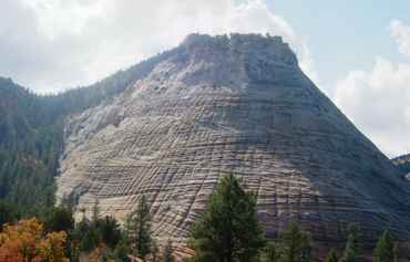 |
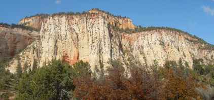 | As you leave the park
you are only leaving an administrative area. The rock formations continue to
be spectacular as we head for Mount Carmel Junction and the road north to
Bryce Canyon. |
|