| So we left Cedar Hills and headed up Provo Canyon towards Heber
City through the Wasatch mountains. A few miles in we came to a state park
and lake at Deer Creek. So we stopped for breakfast with a lovely view. | 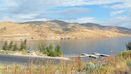 |
 | Then on through the
mountains joining the US 40 heading towards Roosevelt. We passed the
Strawberry Reservoir which stores water (not strawberries). |
| And on to the Starvation Reservoir. There were various signboards
with details of the reservoir, its construction and the local wildlife. But
nothing which explained where it got its name. | 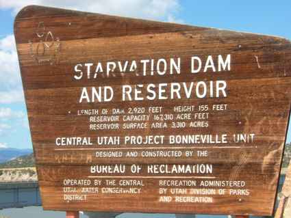 |
 | So we headed onward
moving past the Dinosaur National Park and moving from Utah into Colorado.
US 40 is not one of the most widely travelled roads so we pretty much had it
to ourselves.. |
| Most of the valleys are glacial in origin with these long lines
of cliffs on either side as you travel down the valleys. Most of these used
to be much lower in elevation but have been uplifted by the seismic activity
over the millennia in this area. | 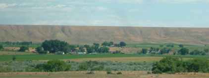 |
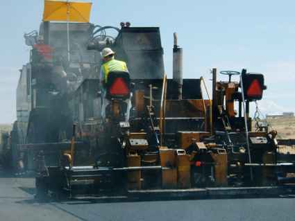 | There are nothing like
as many alternative routes for road works in the US as there are in the UK.
And the road surfaces in many cases are very worn. They do resurface the
roads while you pass in convoy mode on the alternate carriageway. At least
the tarmac roads are better to drive on than the worn concrete surfaces. |
| Colorado is quite a colourful state in its geology. We have
wished we knew more about it and so we have bought a book on the geology of
Colorado. Not that I've had time to open it yet. | 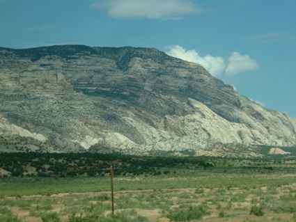 |
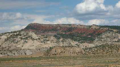 | Moving east from Craig
we found mountains with a particularly colourful red striation. These would
once have been sand deposits on an ocean bed. But now they are at 7000 feet! |
| This went on for a number of miles and the formation is really
quite spectacular. I can't remember what these mountains were called but
they were not far from Steamboat Springs. We are now getting quite close to
the Rockies proper. | 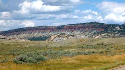 |
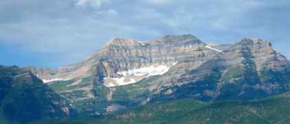
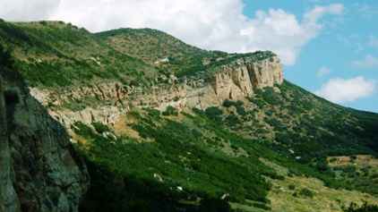 | The Rockies are the
result of a geological uplift and rarely does this seem quite as obvious as
it was here. With the sun at just the right angle and the atmosphere clear,
we got some good photographs. |
| With the mountains also come more lakes and reservoirs. The roads
also become more up and down as you start to travel through passes in
steeper mountains.. | 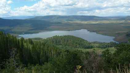 |
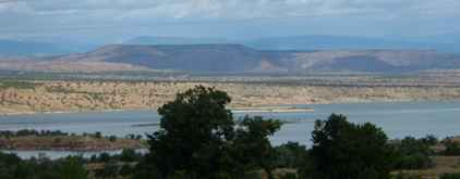
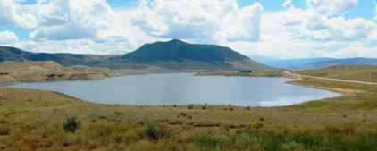 | This was a reservoir
and just looked so peaceful. This was despite the dire looking thunderstorm
which hailed on us just a few minutes later. |
| The last range we passed through had very steep sides and a small
creek. The road went one side and the railway was on the other side. This
was Estes Pass and was the top of a fairly major climb for the railway.
Hence the trains shown below. The rock formations were pretty spectacular
too. | 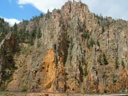 |
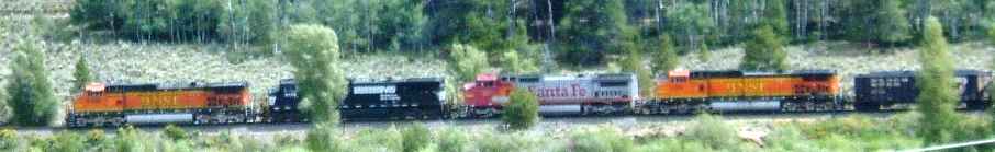 | Up in the Rockies, the
trains need more power so you get four engines on the front most with
different liveries. |
| And so eventually we reached Lake Granby, Colorado, at the edge of
the Rocky Mountain National Park. The weather was still pretty threatening
with rain showers almost hiding the opposite bank of the lake. | 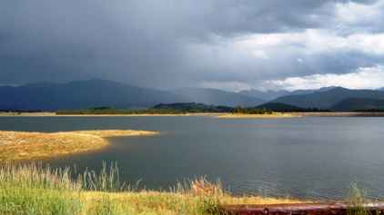 |
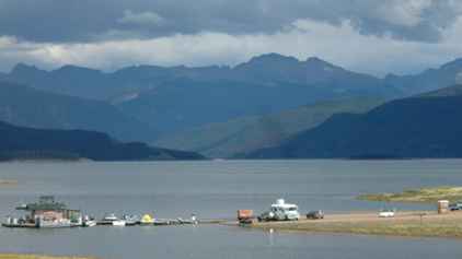 | This is a very popular
area for tourists with cars, boats and campers parked right down on the
shoreline with magnificent scenery all around. There are a series of lakes
here leading up to the resort and lake of Grand Lake. This was Shadow
Mountain Lake or it may have been Stillwater on Lake Granby. This is the
start of the Colorado River. |
|