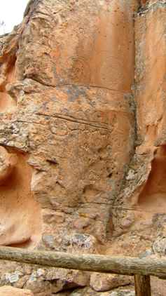
| The Nevada desert was populated in really ancient times and there are prehistoric relics and pictographs on many sites. This was one such site
which we visited. I must confess that it seems difficult to distinguish
between weather erosion, modern graffiti and true prehistoric paintings. I
guess we are just not archeologists. | 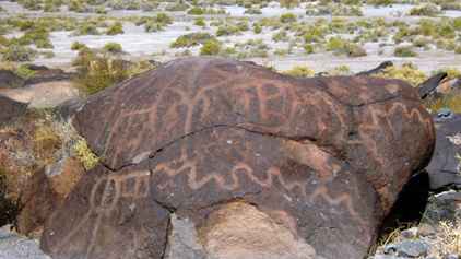 |
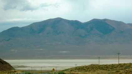
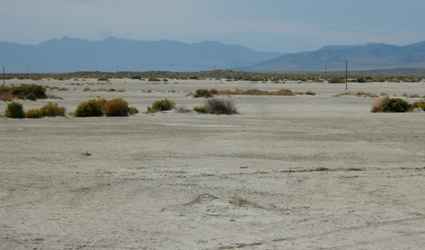 | When it rains here, it
rains, but it dries off very quickly. This leads to salt deposits and makes
for a very inhospitable growing medium. Thus you end up with salt flats with
only odd bits of scrub. This does little to stop the natural erosion. This
is not a populated area. |
| In some areas the construction of the road has interrupted the
natural water flow and in such cases you get dried up water courses
following the roads. Some people had collected small stones and written
their names along the edge of the watercourse. It looked quite artistic but
I think it is just another form of graffiti. | 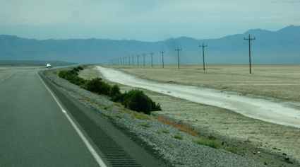 |
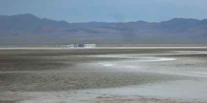 | Sometimes
the ground will not even support the scrub and then you get almost a lake
bottom effect. From a distance it looks wet and it is easy to see how
mirages happen. We saw a number of 'dry' lakes. |
| A bit further on we came to Sand Mountain. Actually it is within
its own sate park and is very popular with the ATV community who race up and
down the hill. The wind catches the top of the ridge and causes the dune to
'sing' when it is blowing at the right frequency. Most of the desert is much
coarser so Sand Mountain was an unusual feature. | 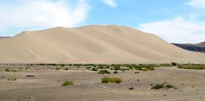 |
 | Nevada is not flat,
there are a number of mountain ranges. It is often described as a series of
basins which once upon a time would have held water. There are over 90 of
these basins between California and Utah. |
| At times it seems endless as you come over the gap in the
mountains only to have another vista, just like the last one with a road
snaking across it for what seems like miles. This is still US 50, the
Loneliest Road! | 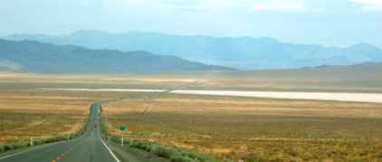 |
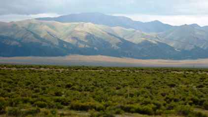 | Some valleys have
slightly more ground water and so you get rather more scrub, and the
mountains in the background can look quite attractive as the sun catches
them. If there is any sort of weather system about, then the light is
constantly changing and the beauty of the view spread before you changes by
the minute. |
| But often the road is dead straight, down one hillside, across
the flat bottom of the basin and then up the other side. The road across is
often 20 miles without a curve, and you can drive it without seeing another
vehicle. | 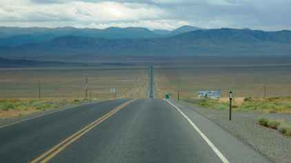 |
 | And when you need a
break, you can stop in at the next set of petroglyphs. Although by now it
was becoming a case of petroglyphs, so?. Even though these were reputed to
be 10,000 years old and had their own state park and campground. The
campground was empty so we aren't the only heathens.... |
| It was interesting to watch the weather as it moved from north to
south as we went west to east. We never quite managed to be in the rainfall
although it was obvious that there was significant water falling.. | 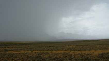 |
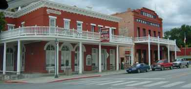 | There were occasional
towns (usually populations below 1,000). This was the old mining community
of Eureka, named after the Greek for 'I have found it!' Apart from cars
replacing horses and the population having shrunk by a factor of 10, these
places have not changed much in a century. |
| There was little real change to the landscape, although it was
changing gradually. We eventually stopped at a town called Ely. One thing
you start to do in every town is to look at the gas stations. In this part
of the world you never let the tank go below a quarter full. Gas stations
can be, and are, 200 miles apart! | 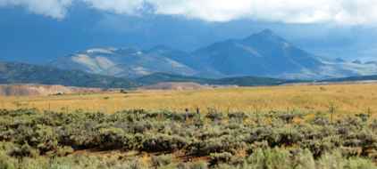 |
|